- Latest available (Revised)
- Original (As made)
The Public Bodies (Abolition of BRB (Residuary) Limited) Order 2013
You are here:

What Version
More Resources
Status:
This is the original version (as it was originally made). This item of legislation is currently only available in its original format.
Article 2
SCHEDULENR PROPERTIES
This schedule has no associated Explanatory Memorandum
Unregistered Land and Structures
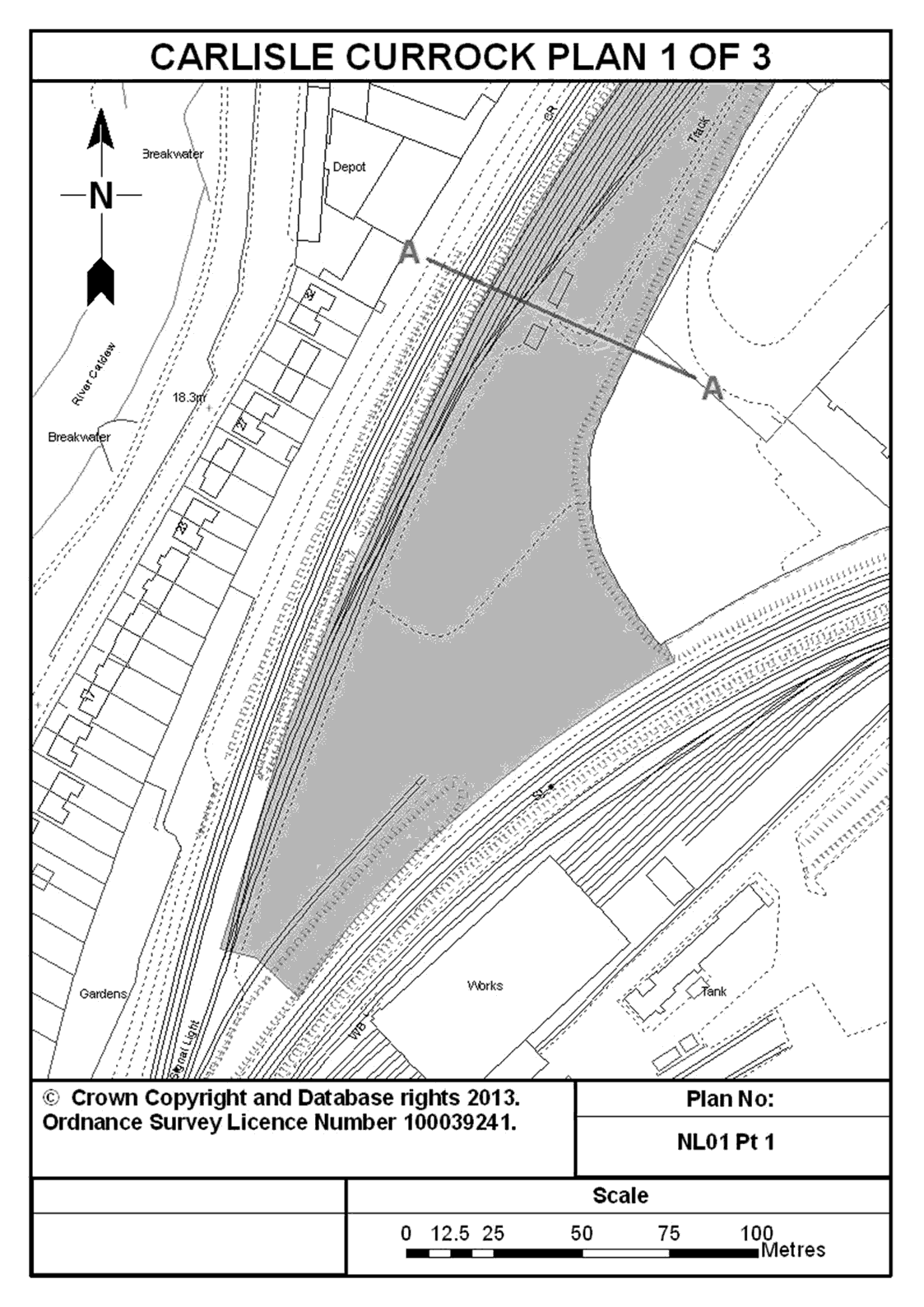
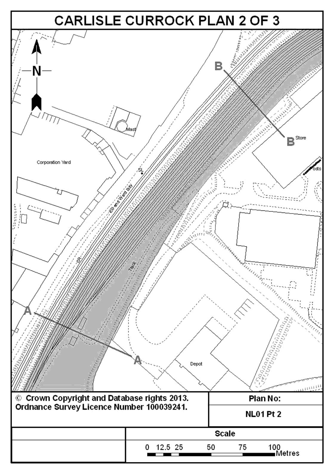
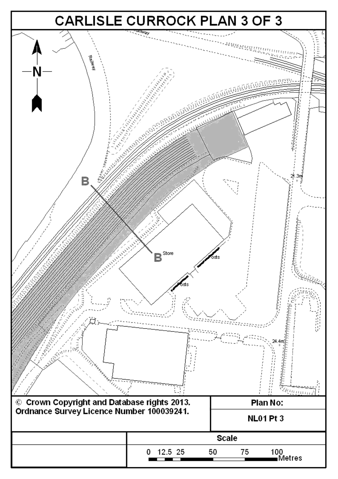
1. Land adjoining the operational railway and east of Bousteads Grassing at Carlisle Currock in Cumbria and shown shaded in blue on plans NL01 Pt 1, NL01 Pt 2 and NL01 Pt 3 entitled “Carlisle Currock” in the Annex to this Schedule.
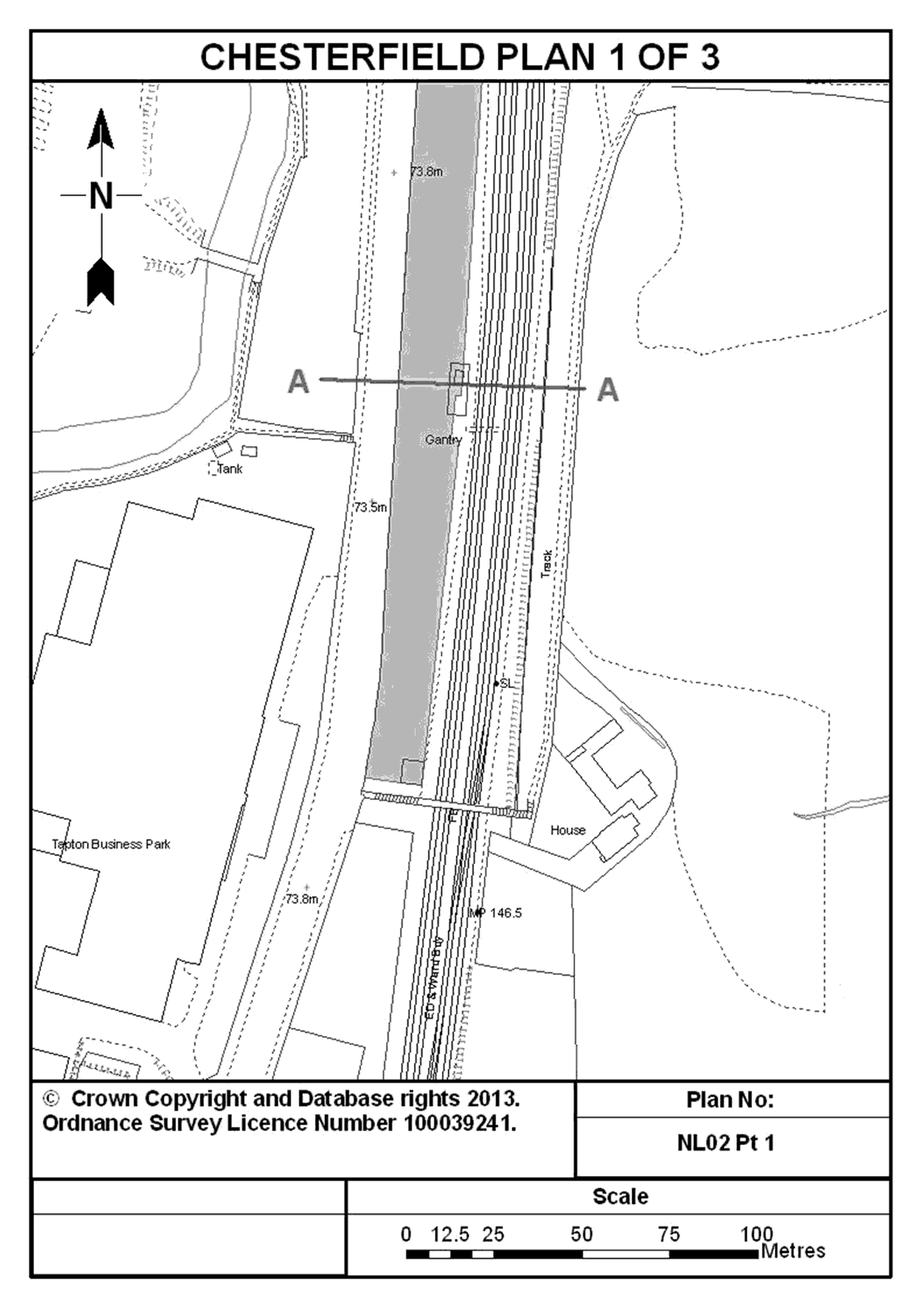
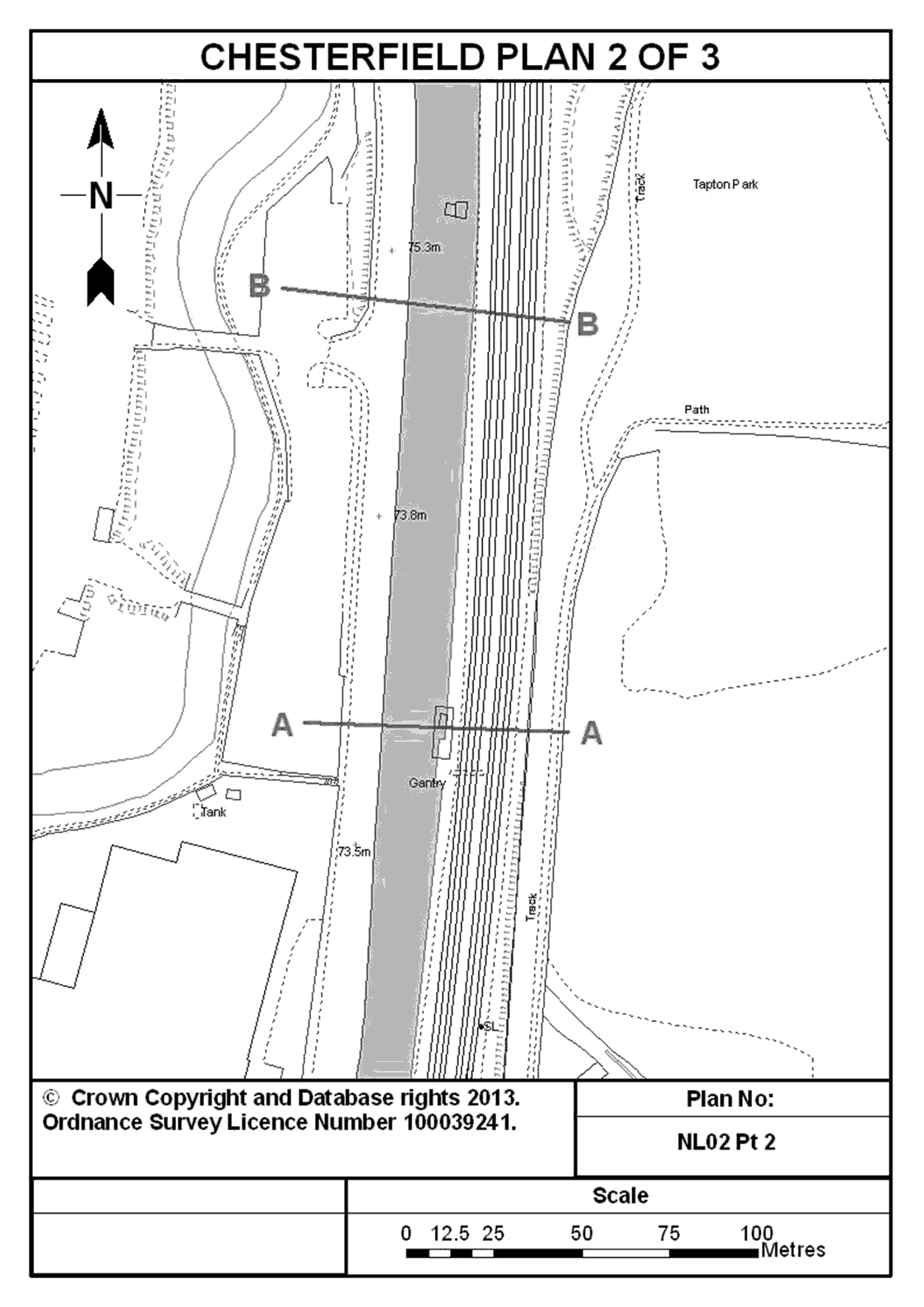
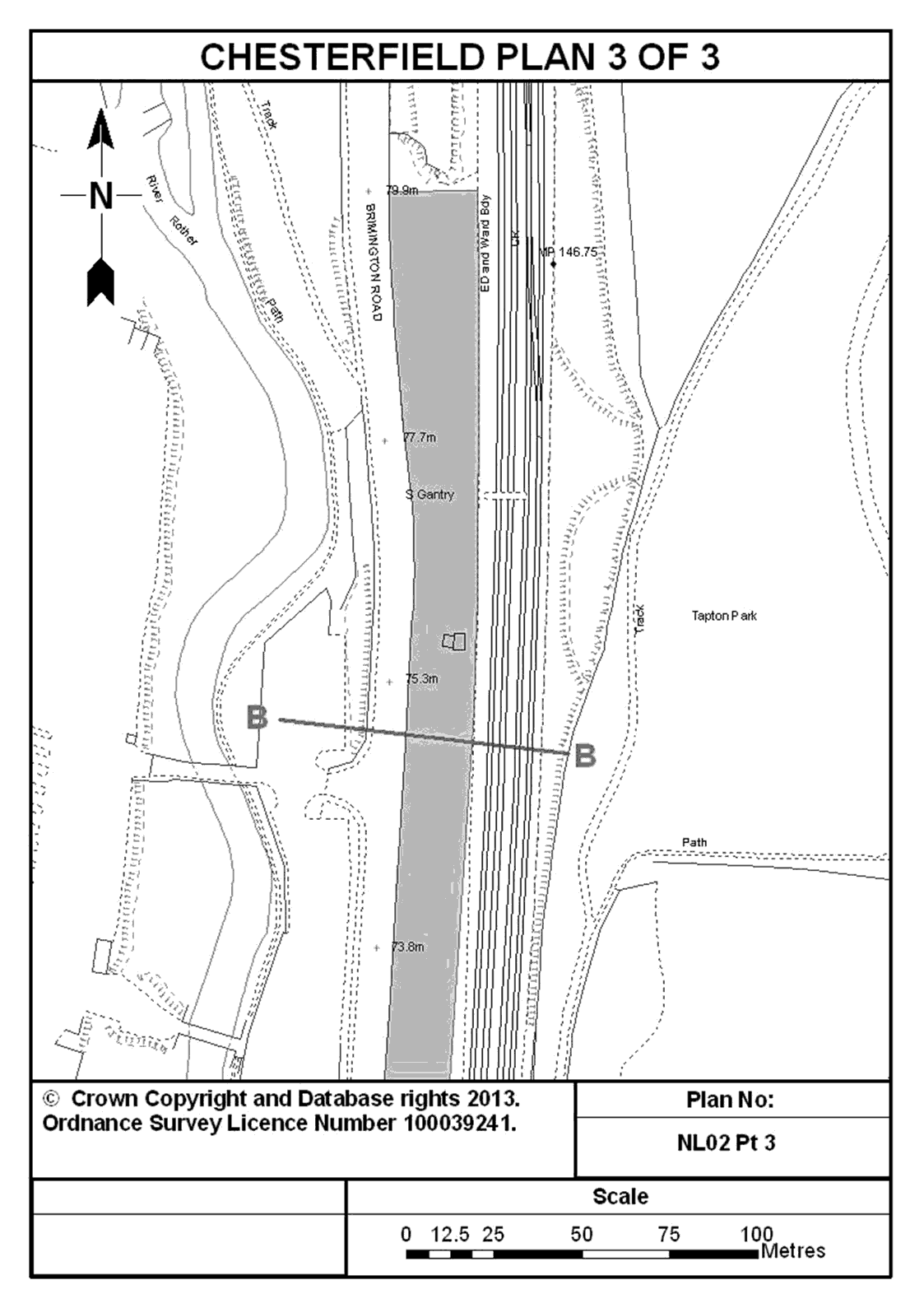
2. Land adjoining the operational railway and east of Brinnington Road at Chesterfield in Derbyshire and shown shaded in blue on plans NL02 Pt1, NL02 Pt2 and NL02 Pt 3 entitled “Chesterfield” in the Annex to this Schedule.
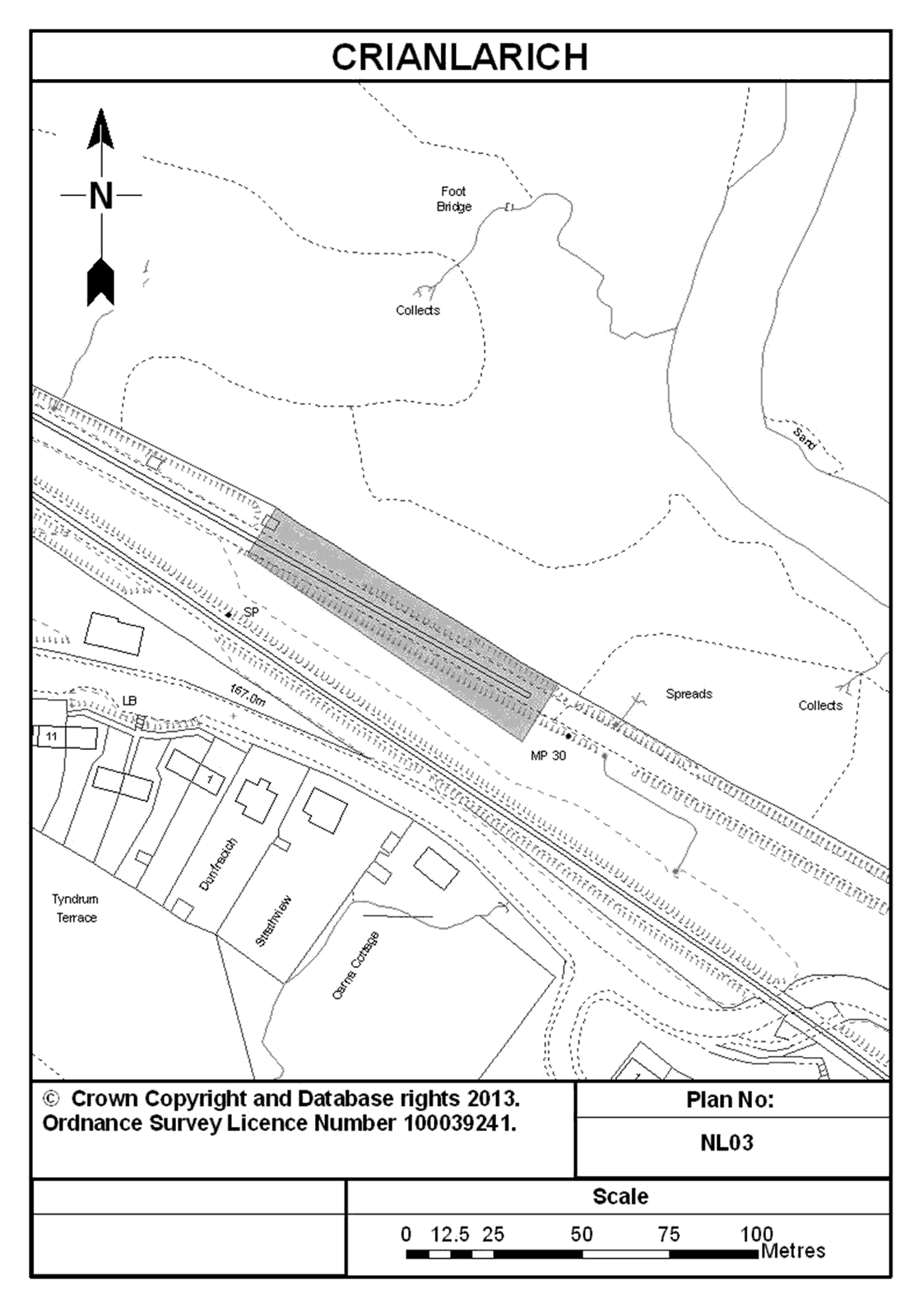
3. Land adjoining the operational railway comprising part of the closed railway line from Callander at Crianlarich in the County of Perth and shown shaded in blue on plan NL03 entitled “Crianlarich” in the Annex to this Schedule.
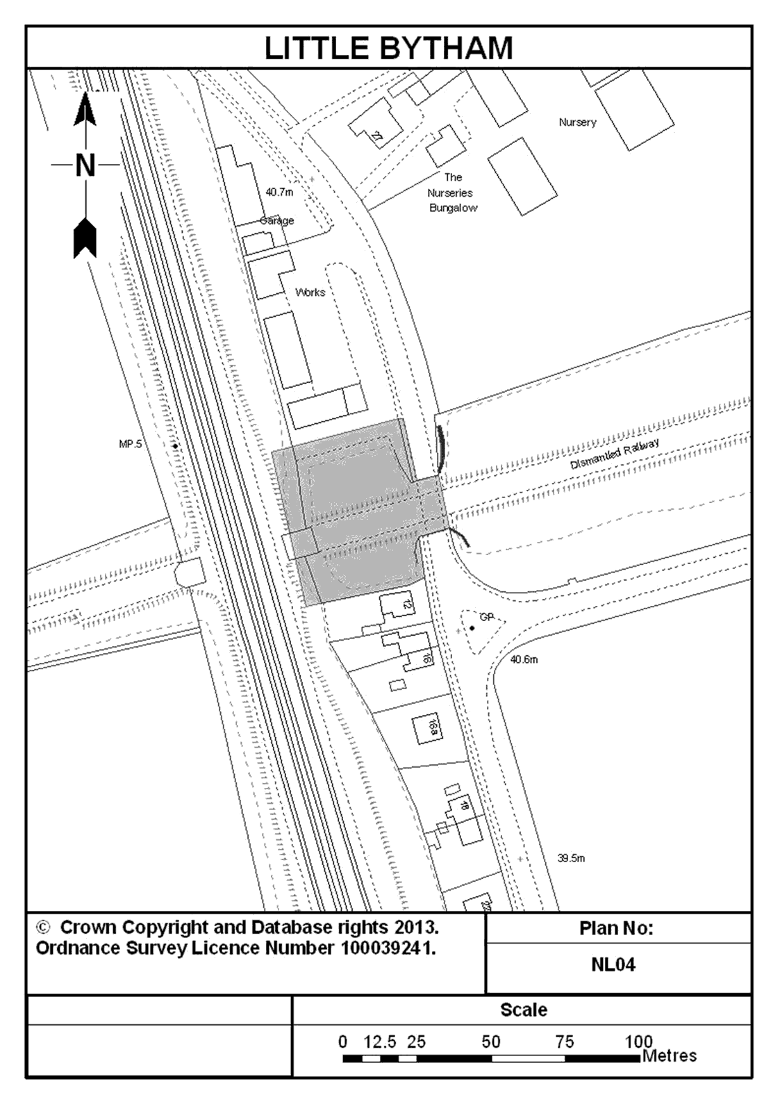
4. Land and bridge adjoining the operational railway to the north of number 12 Station Road, Little Bytham in Lincolnshire and with the land and bridge shown shaded in blue and the wing walls shown marked in dark blue on plan NL04 entitled “Little Bytham” in the Annex to this Schedule.
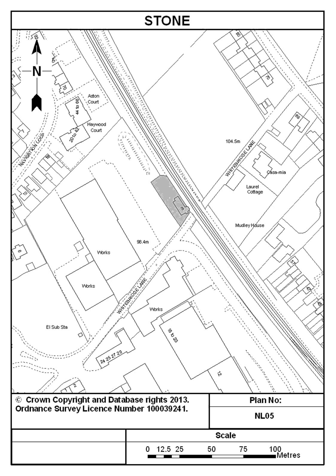
5. Land adjoining the operational railway on the north west side of Whitebridge Lane, including the property known as Whitebridge Crossing Cottage at Stone in Staffordshire and shown shaded in blue on plan NL05 entitled “Stone” in the Annex to this Schedule.
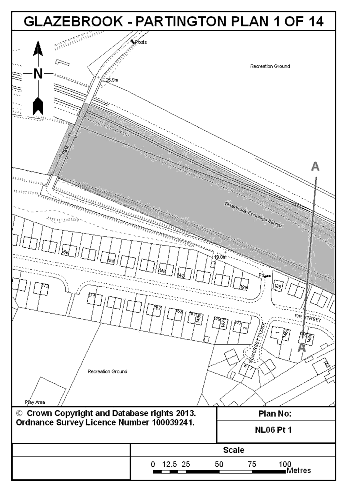
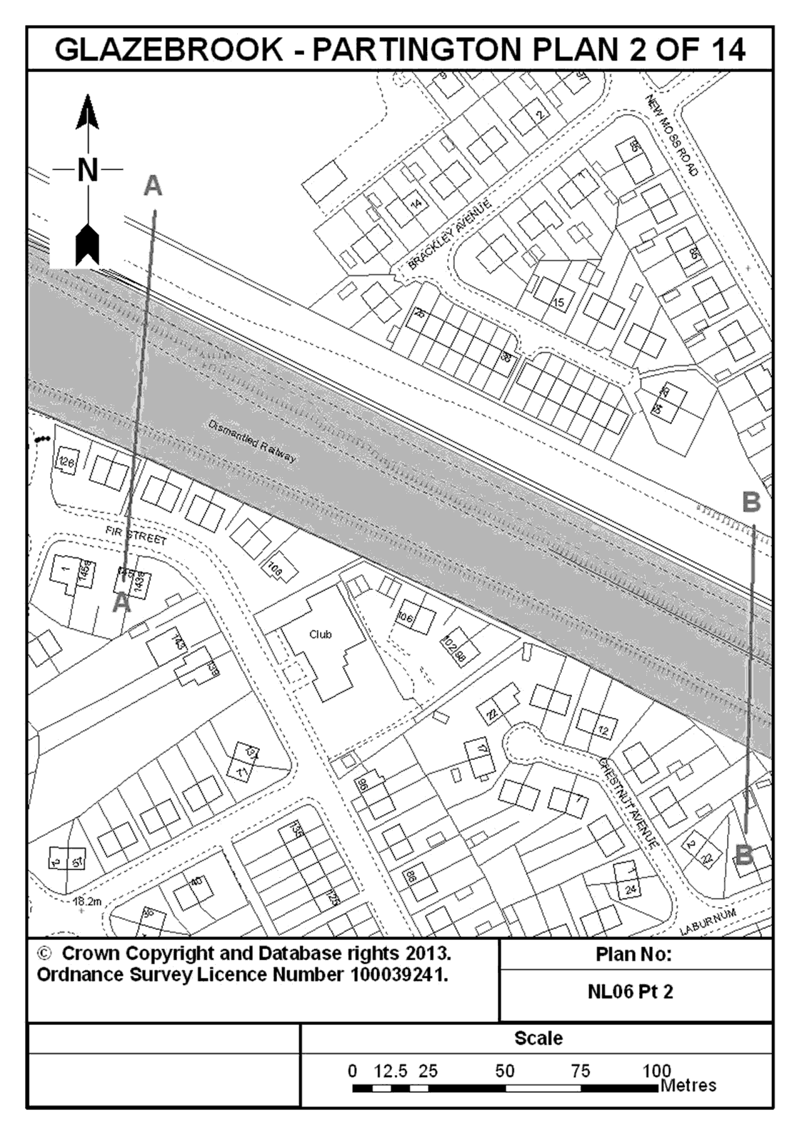
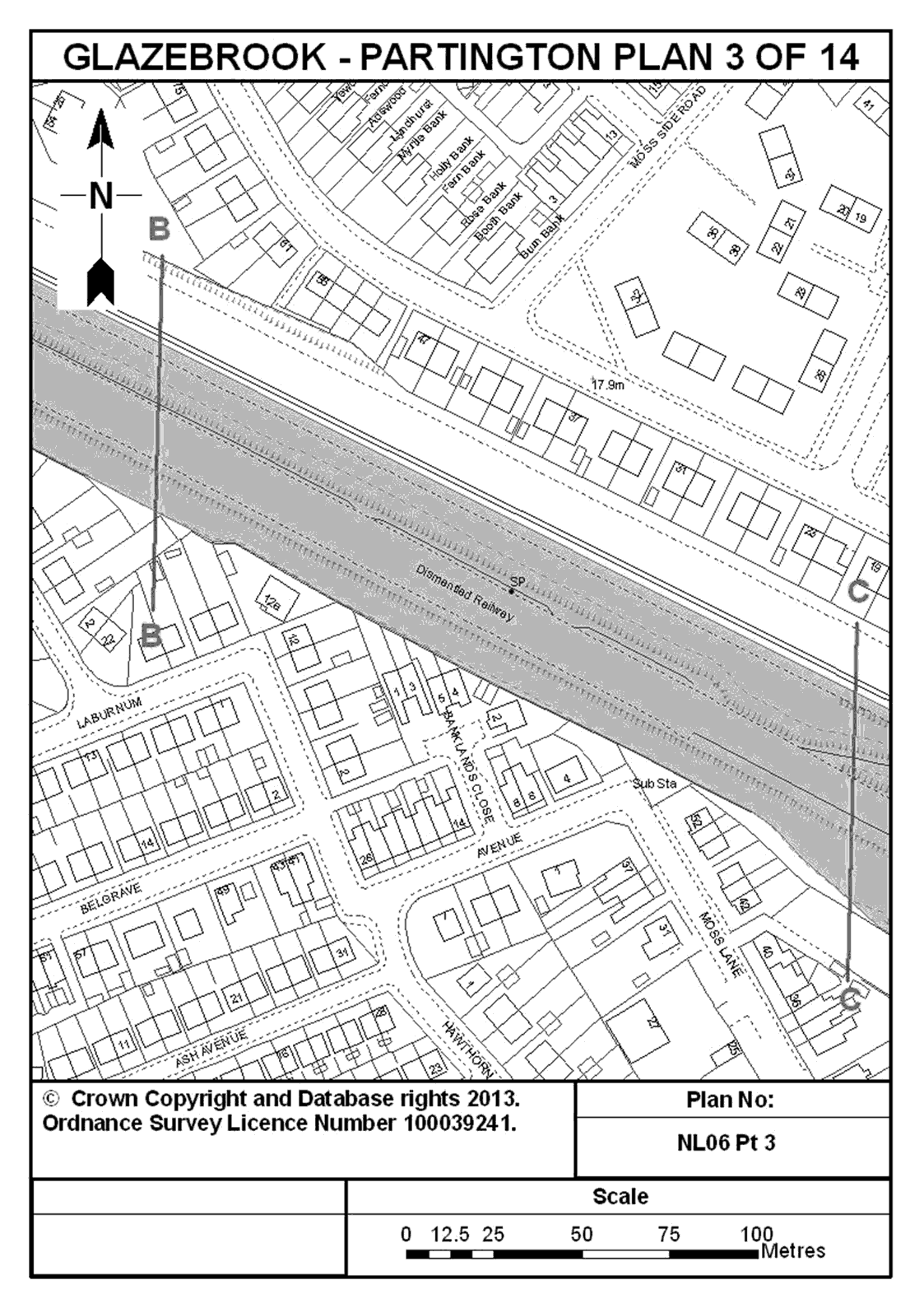
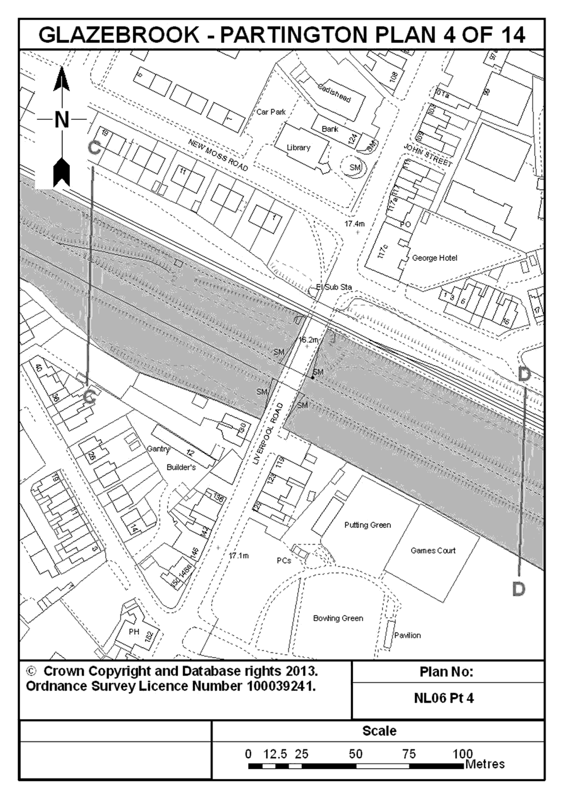
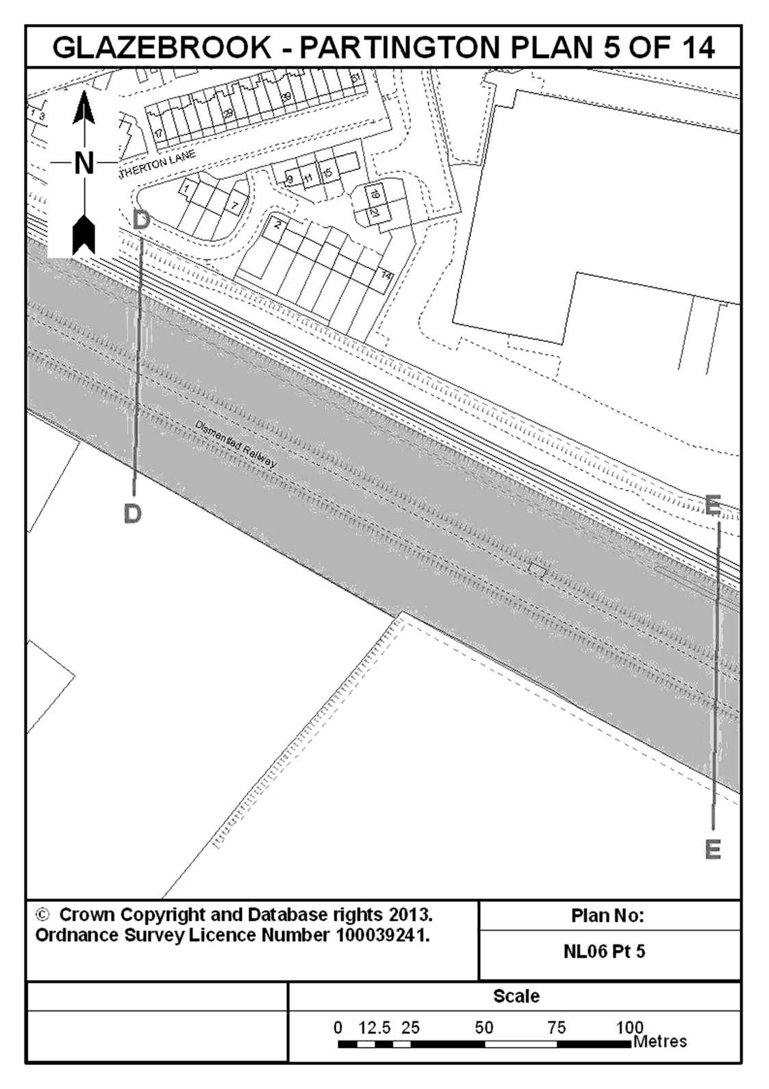
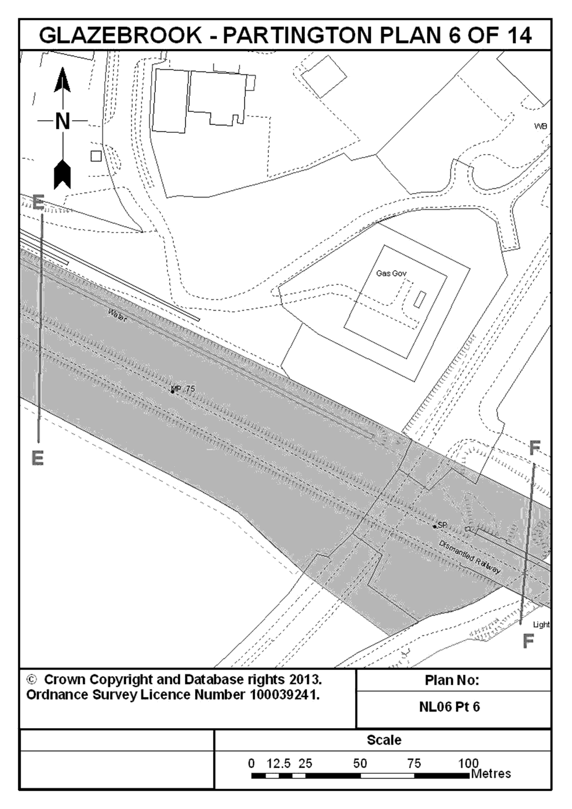
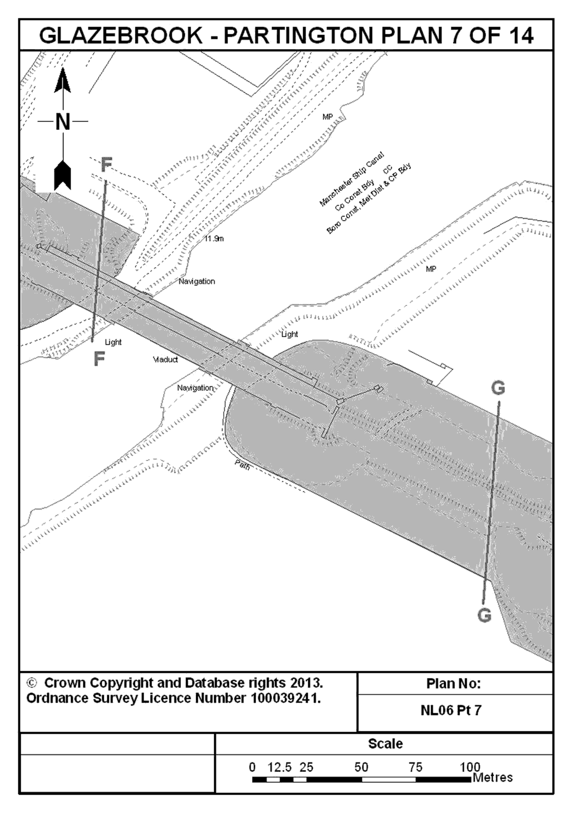
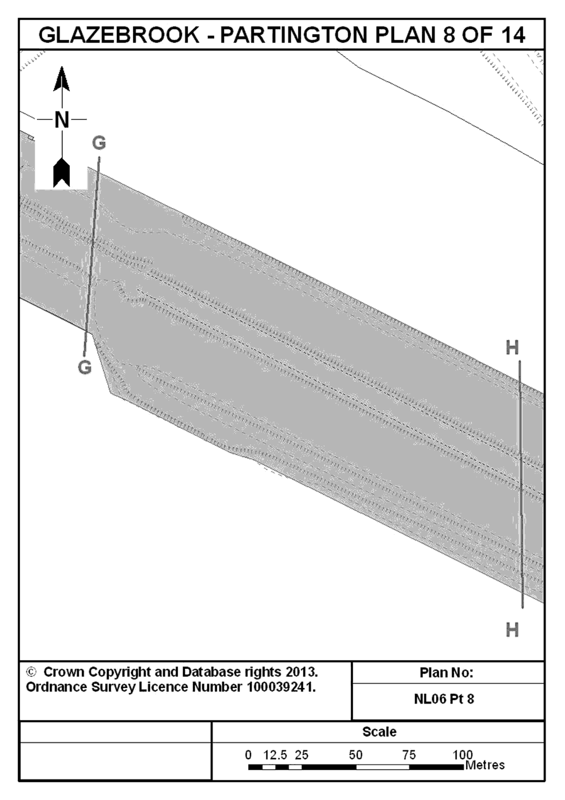
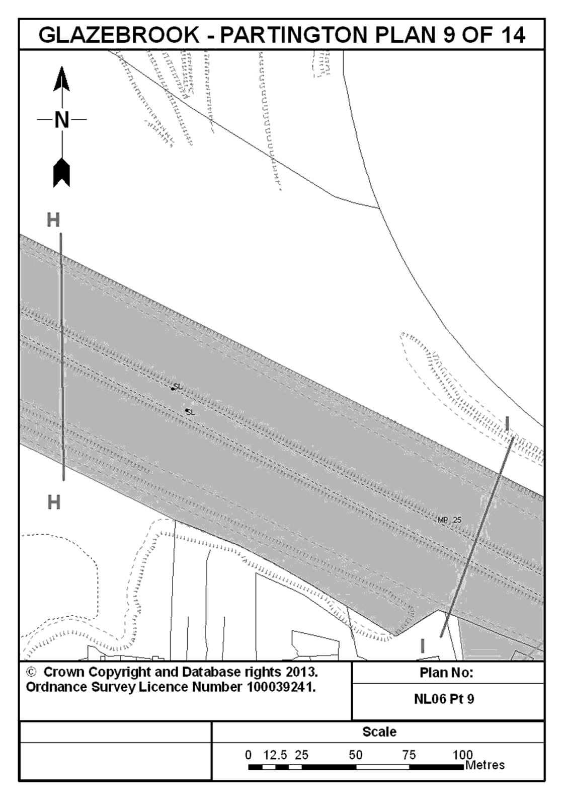
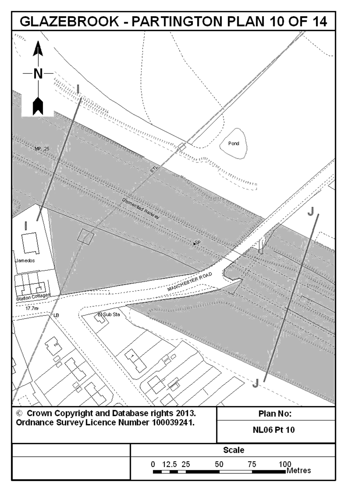
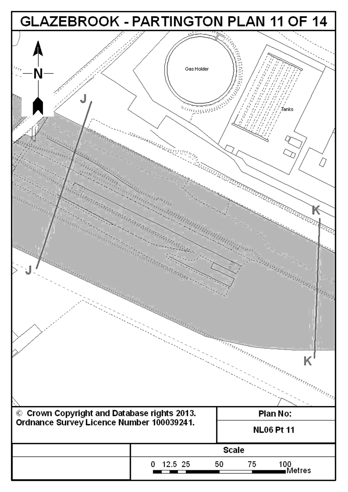
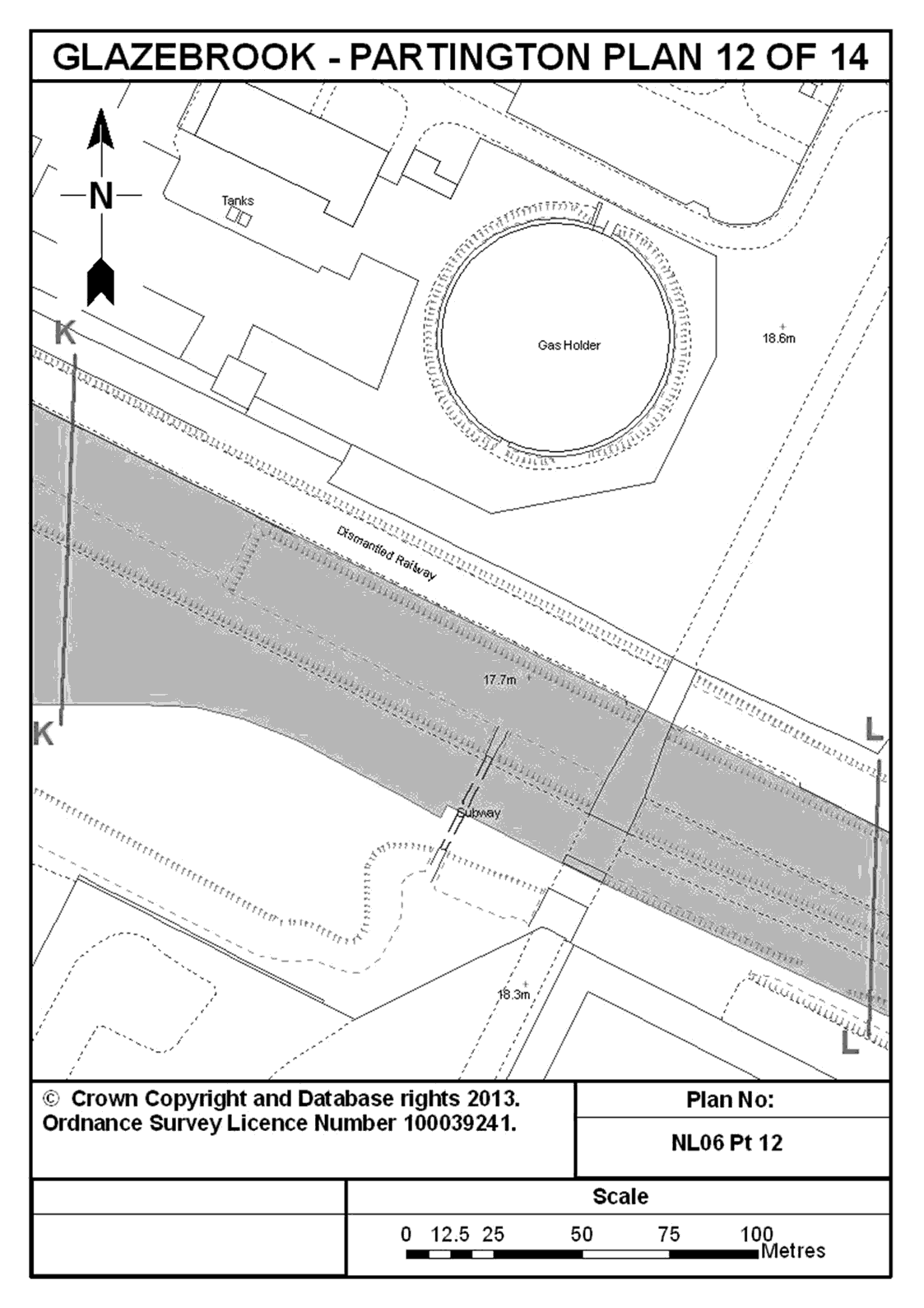
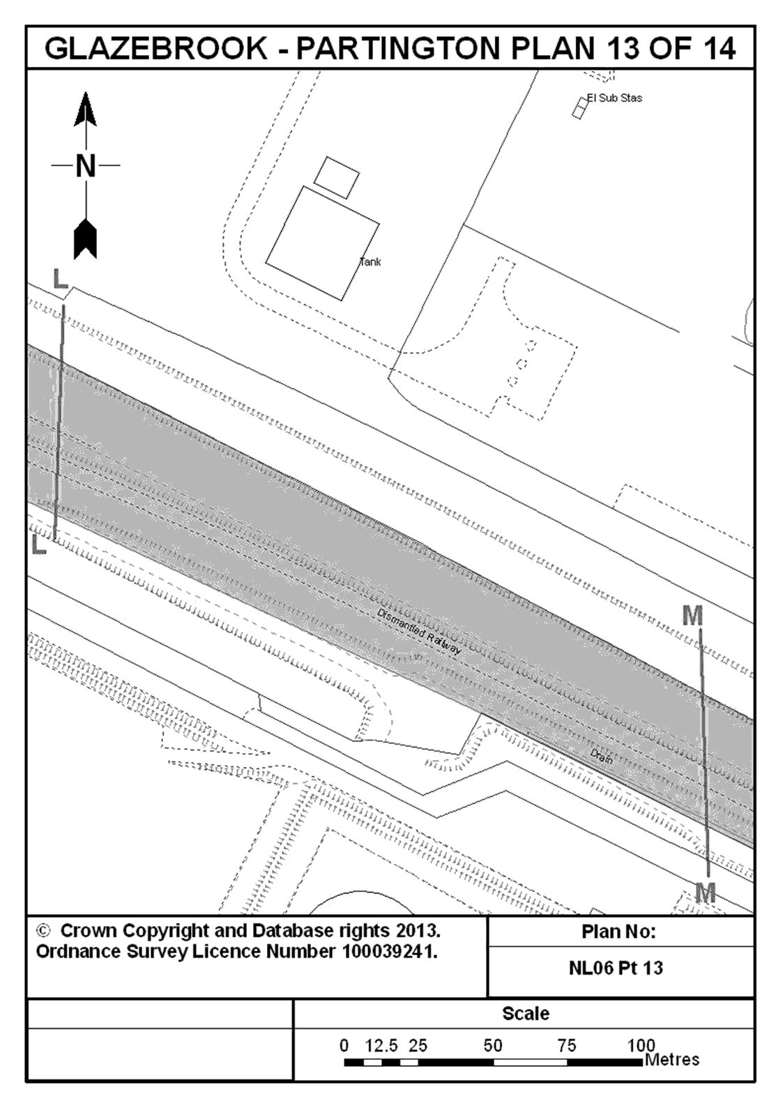
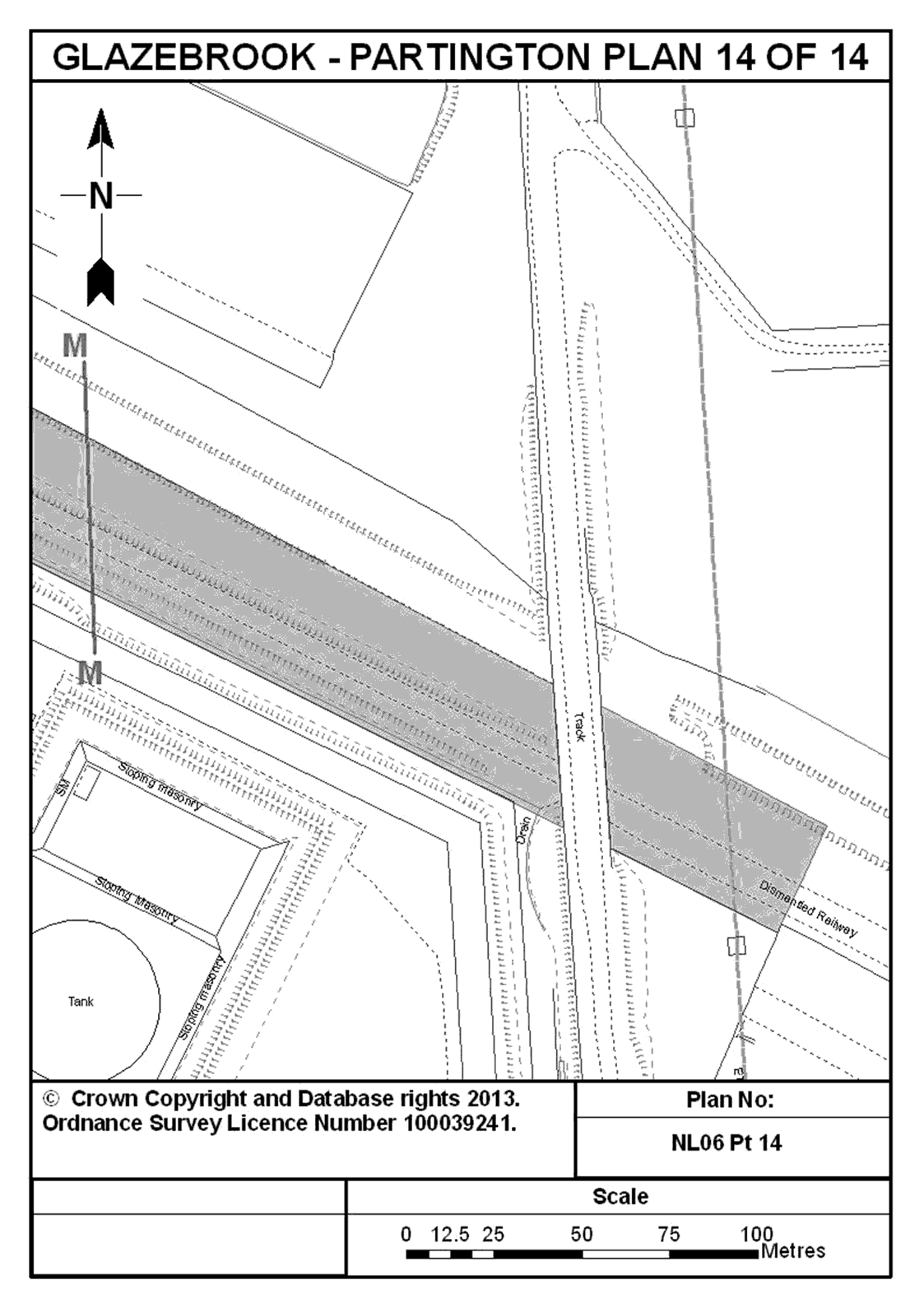
6. Land comprising the closed railway line and associated structures between Partington and the former Glazebrook Exchange Sidings to the north of Fir Street in Glazebrook, in Greater Manchester and shown shaded in blue on plans NL06 Pt 1 to NL06 Pt 14 entitled “Glazebrook - Partington” in the Annex to this Schedule.
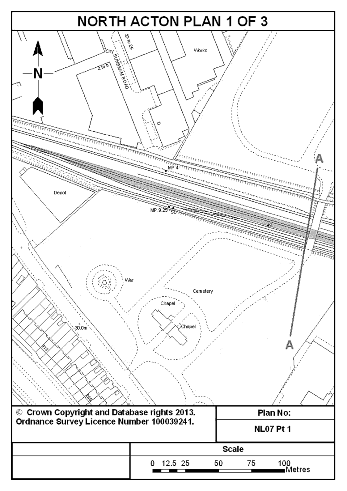
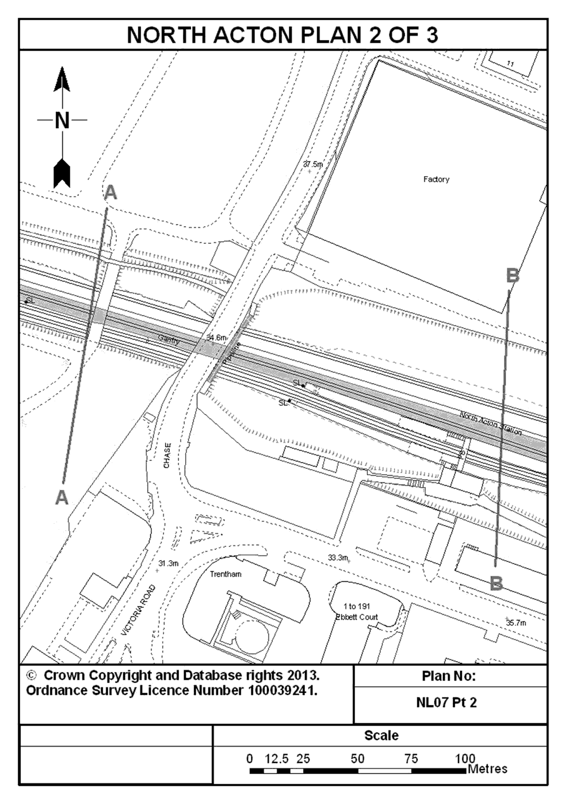
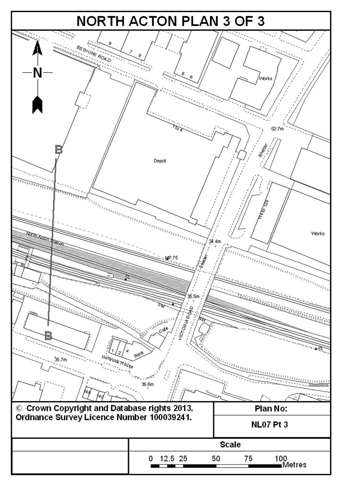
7. Land adjoining the operational railway at North Acton Station, in the London Borough of Ealing, adjacent to the eastbound Central Line platform and shown shaded in blue on plans NL07 Pt 1, NL07 Pt 2 and NL07 Pt 3 entitled “North Acton” in the Annex to this Schedule.
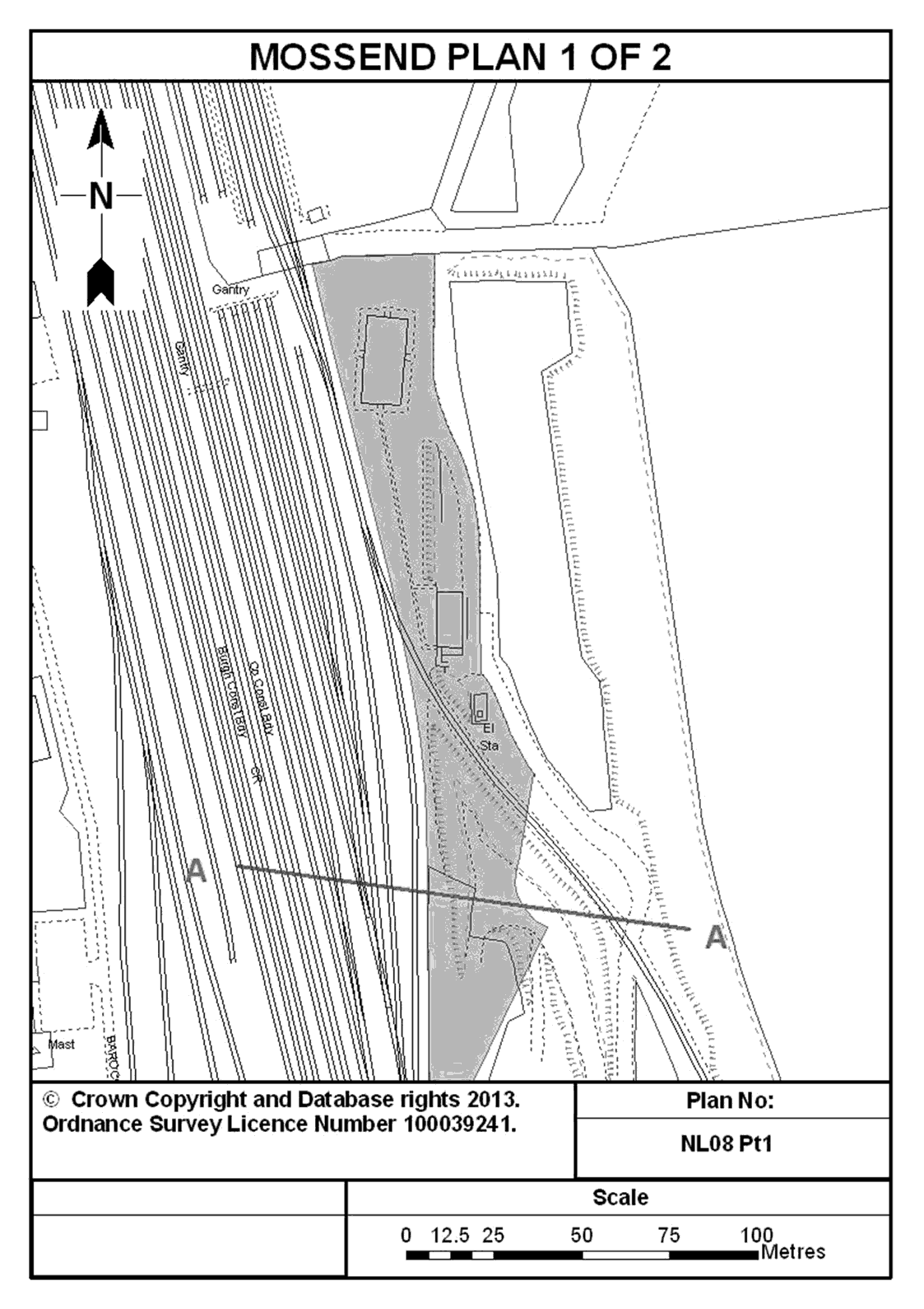
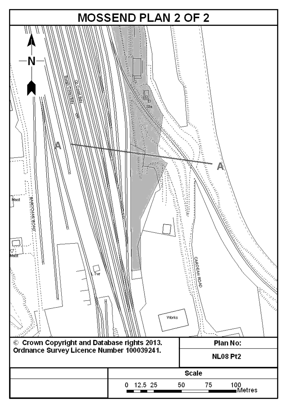
8. Land adjoining the operational railway between Motherwell and Larbert at the north end of Cardean Road, Mossend in North Lanarkshire and shown shaded in blue on plans NL08 Pt 1 and NL08 Pt 2 entitled “Mossend” in the Annex to this Schedule.
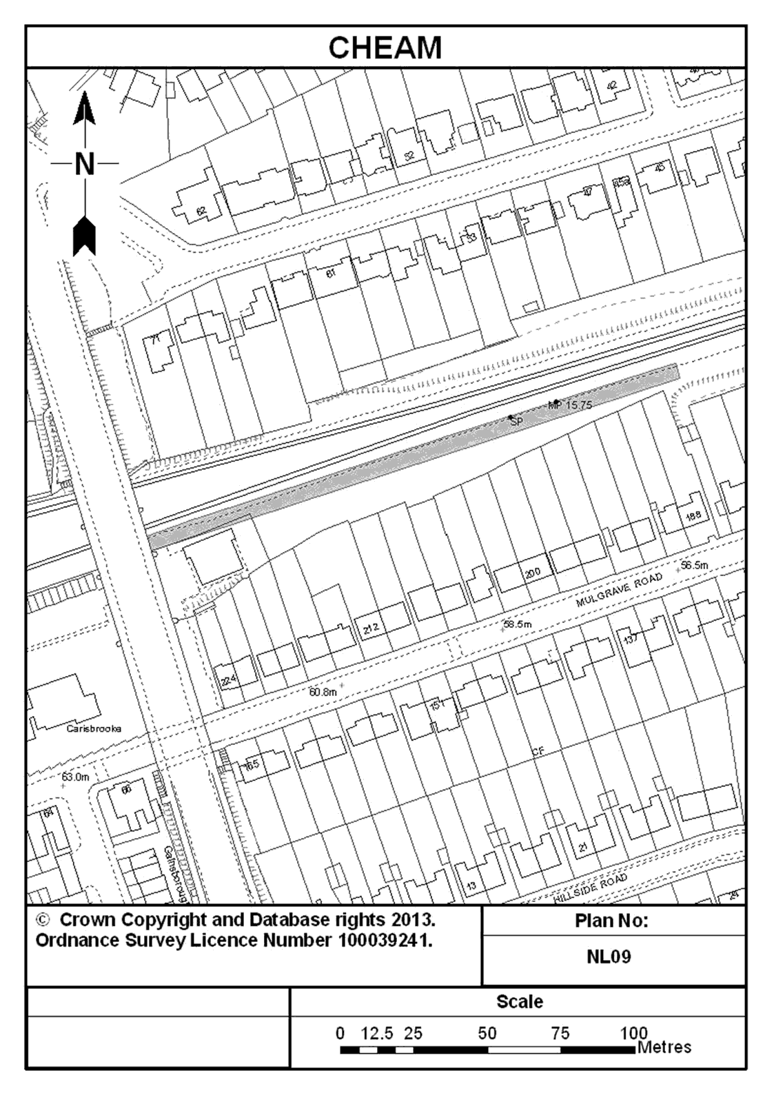
9. Land adjoining the operational railway east of Cheam railway station and north of Mulgrave Road in the London Borough of Sutton and shown shaded in blue on plan NL09 entitled “Cheam” in the Annex to this Schedule.
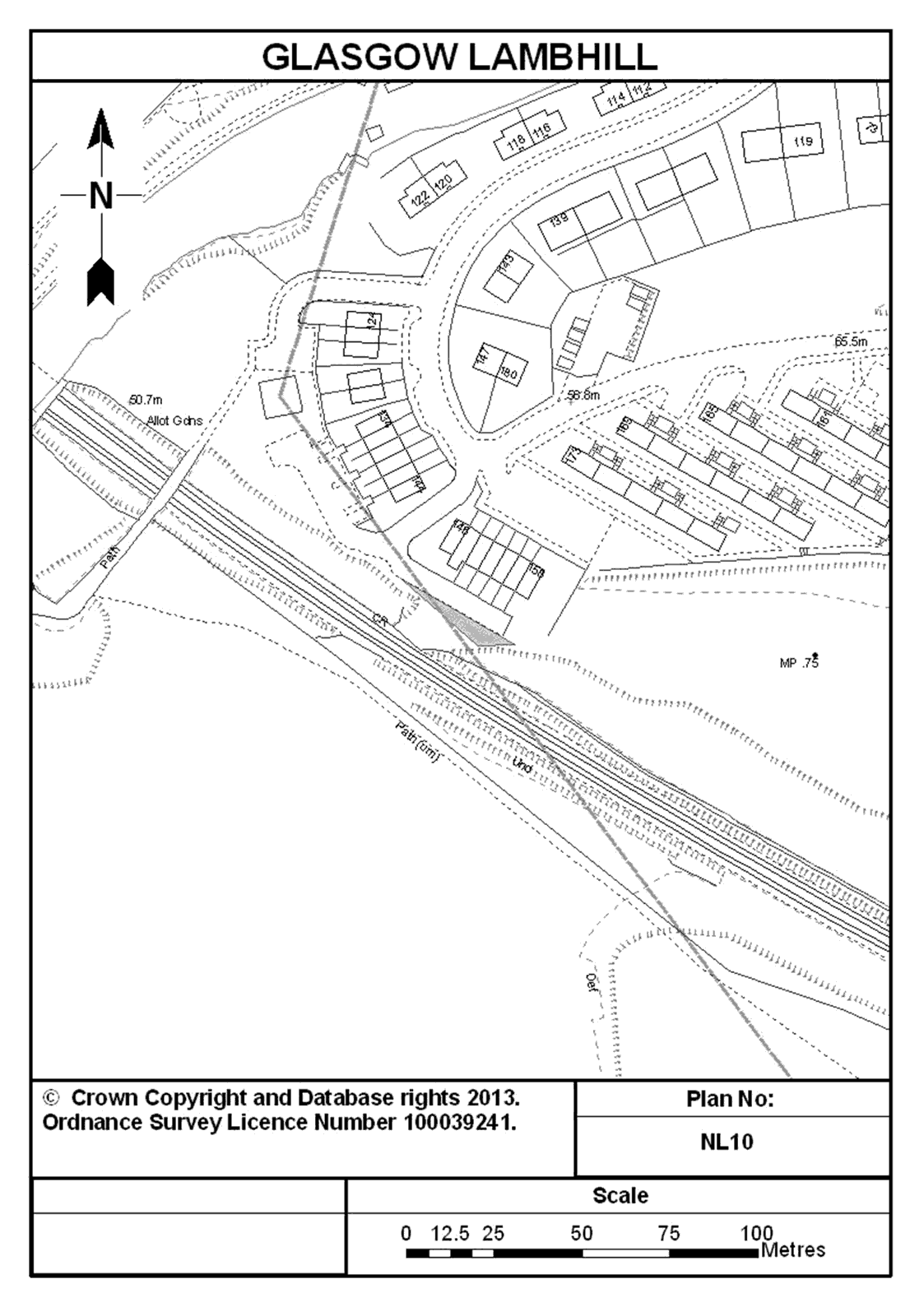
10. Land adjoining the operational railway and south of Erradale Street at Lambhill in the City of Glasgow and shown shaded in blue on plan NL10 entitled “Glasgow Lambhill” in the Annex to this Schedule.
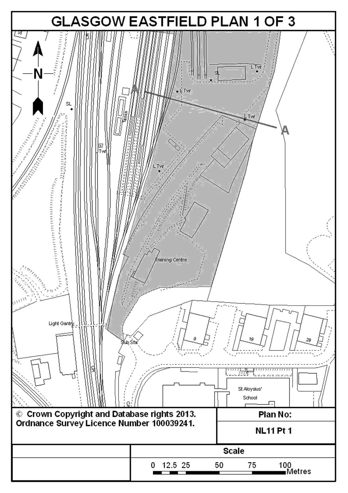
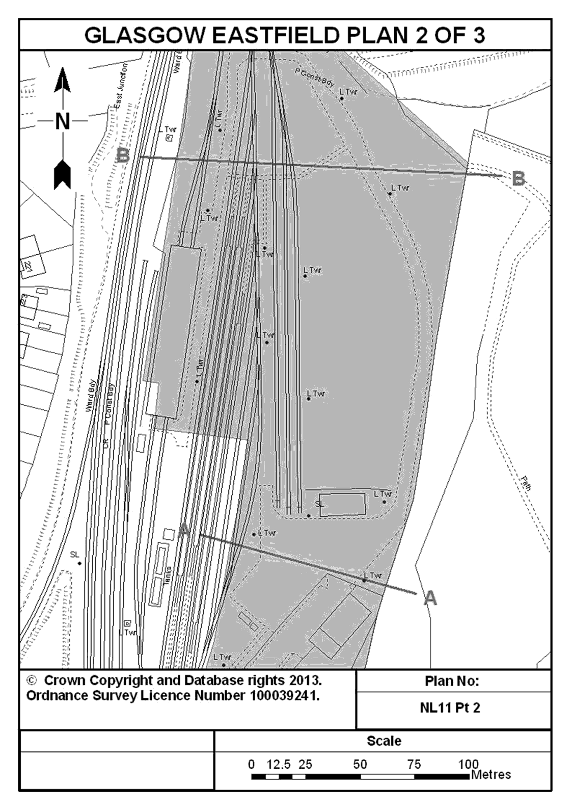
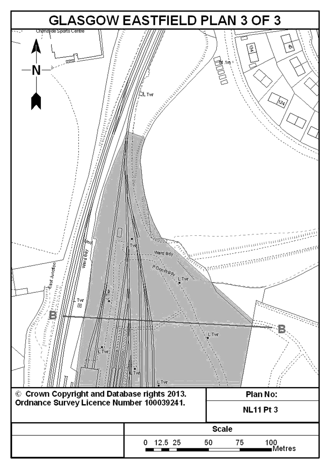
11. The land located at Glasgow Eastfield Depot, comprising the light maintenance depot, adjacent to the operational railway and associated land accessed from Carron Crescent in the City of Glasgow and shown shaded in blue on plans NL11 Pt 1, NL11 Pt 2 and NL11 Pt 3 entitled “Glasgow Eastfield” in the Annex to this Schedule.
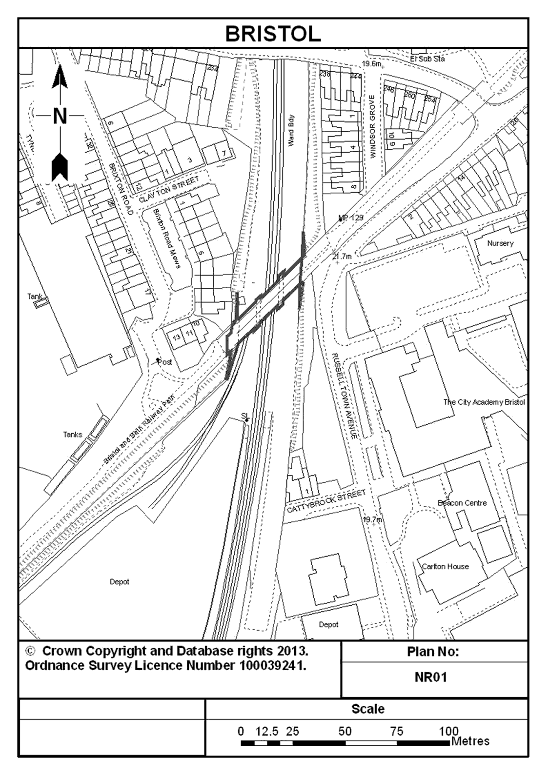
12. An underbridge south east of Brixton Road in Bristol that supported the Bristol to Mangotsfield closed railway line, and spans the operational railway between Lawrence Hill and Stapleton Road Stations, in the City of Bristol, and shown marked in dark blue on plan NR01 entitled “Bristol” in the Annex to this Schedule.
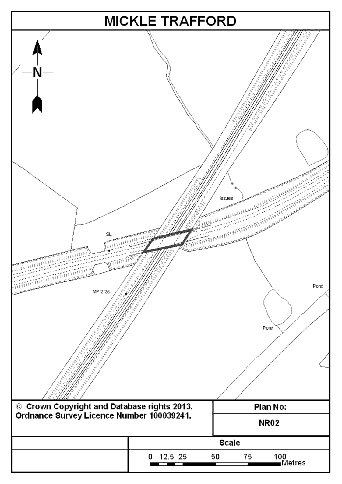
13. An underbridge south of Mickle Trafford that supported the Mickle Trafford to Dee Marsh closed railway line, and spans the operational railway between Chester Station and Mickle Trafford Junction, Cheshire, and shown marked in dark blue on plan NR02 entitled “Mickle Trafford” in the Annex to this Schedule.
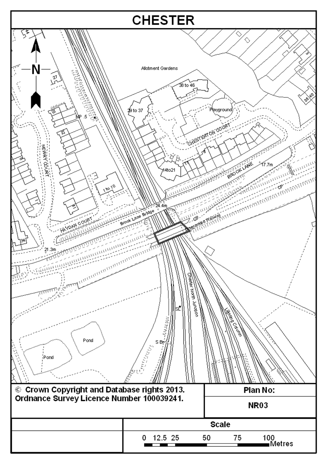
14. An underbridge south of Brook Lane in Chester that supported the Mickle Trafford to Dee Marsh closed railway line, and spans the operational railway between Chester and Bache Stations, Cheshire, and shown marked in dark blue on plan NR03 entitled “Chester” in the Annex to this Schedule.
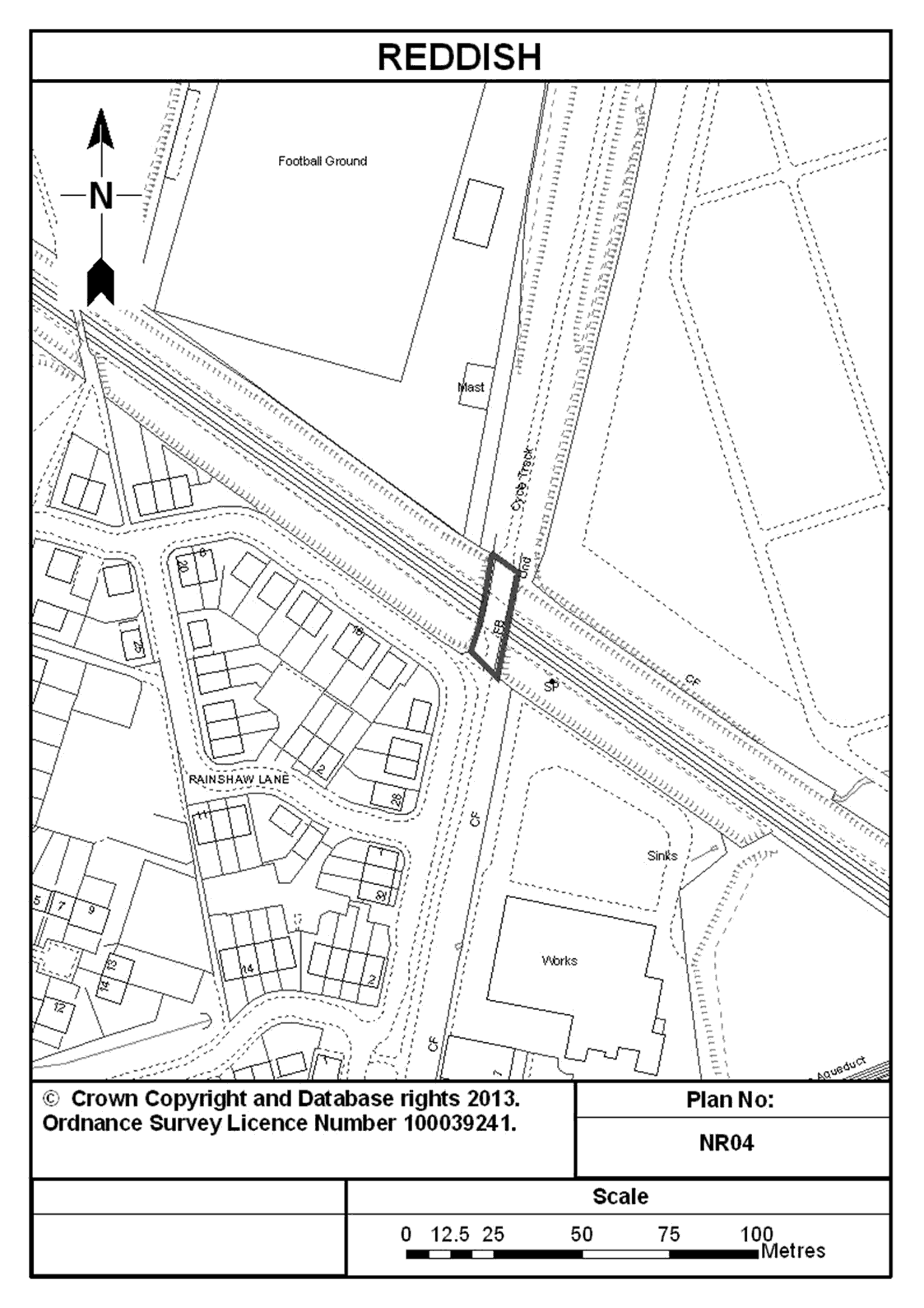
15. An underbridge north east of Rainshaw Lane in Reddish that supported the Fairfield Junction to Chorlton Junction closed railway line, and spans the operational railway between Ryder Brow and Reddish North Stations, Greater Manchester, and shown marked in dark blue on plan NR04 entitled “Reddish” in the Annex to this Schedule.
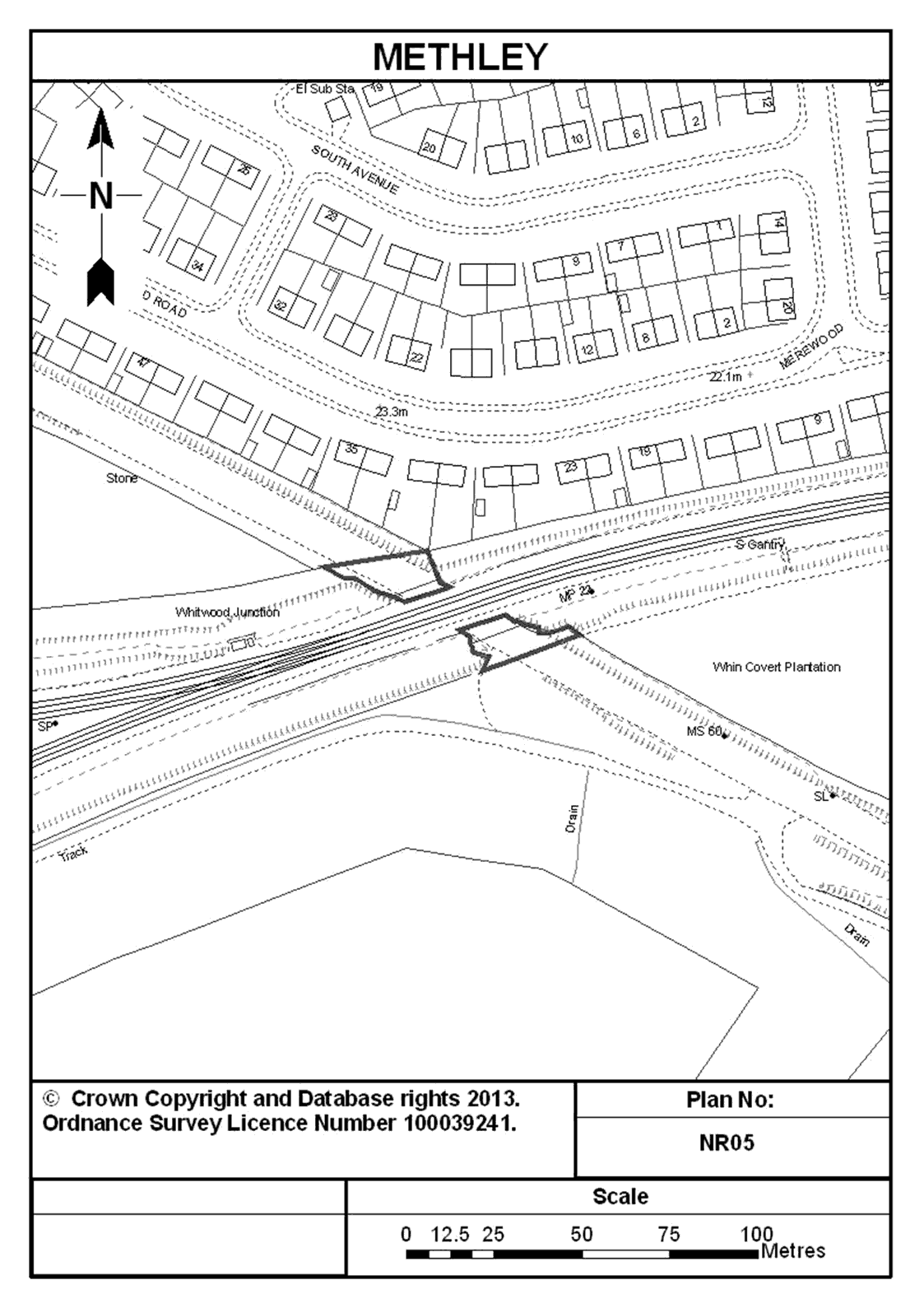
16. Abutments (retaining walls) south of Merewood Road, near Methley that were part of the former bridge that supported the Methley to Pontefract closed railway line, and formerly spanned the operational railway between Castleford Station and Methley Junction, West Yorkshire, and shown marked in dark blue on plan NR05 entitled “Methley” in the Annex to this Schedule.
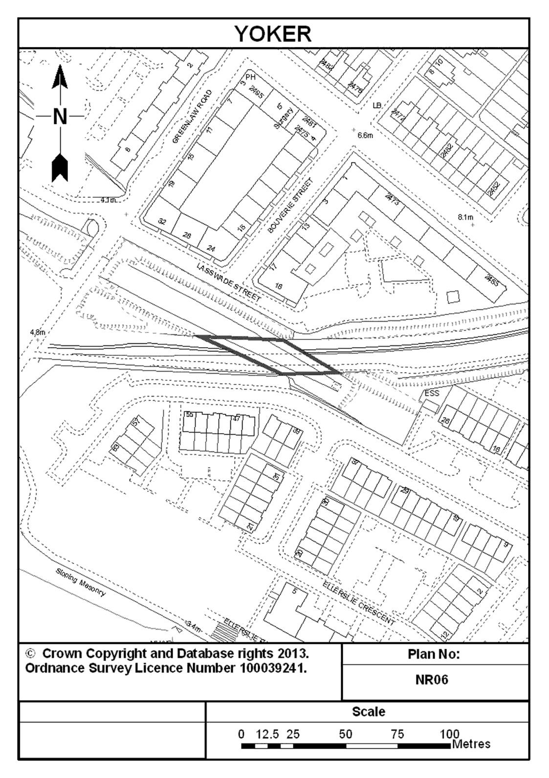
17. An underbridge south of Lasswade Street at Yoker in Glasgow that supported the Partick Central to Old Kilpatrick closed railway line, and spans the operational railway at Rothesay Dock in the City of Glasgow, and shown marked in dark blue on plan NR06 entitled “Yoker” in the Annex to this Schedule.
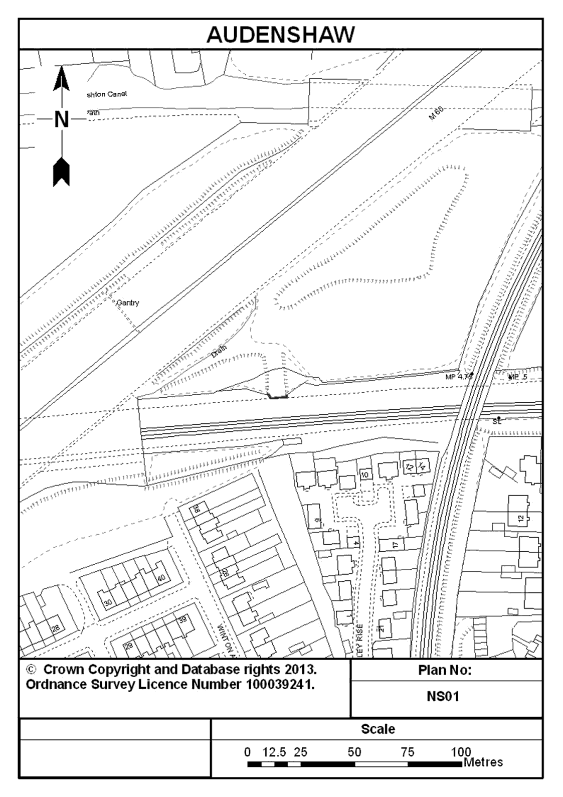
18. An abutment (retaining wall) north of Thornley Rise at Audenshaw, Greater Manchester that was part of the former bridge that supported the Denton to Droylsden closed railway line and formerly spanned the operational railway between Fairfield and Guide Bridge Stations and shown marked in dark blue on plan NS01 entitled “Audenshaw” in the Annex to this Schedule.
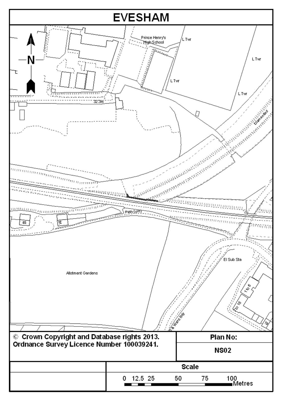
19. An abutment (retaining wall) south of Prince Henry’s High School at Evesham in Worcestershire that was part of the former bridge that supported the Redditch to Evesham closed railway line and formerly spanned the operational railway between Evesham and Honeybourne Stations, and shown marked in dark blue on plan NS02 entitled “Evesham” in the Annex to this Schedule.
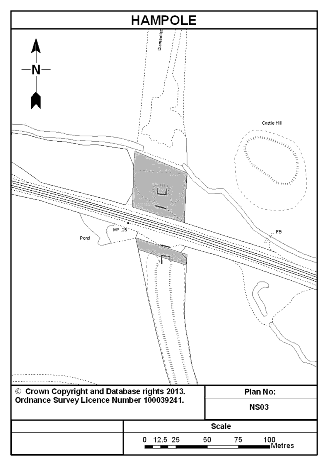
20. Piers and abutments (retaining walls) and associated parcels of land at Hampole in South Yorkshire that were part of the former bridge that supported the Denaby to Wrangbrook Junction closed railway line, and formerly spanned the operational railway between Doncaster and Wakefield Station Junction, located 300 metres east of the bridge carrying Leys Lane over the said operational railway and with the land shown shaded in blue and the piers, abutments (retaining walls) shown marked in dark blue on plan NS03 entitled “Hampole” in the Annex to this Schedule.
21. Abutments (retaining walls) south of Erradale Street at Lambhill in the City of Glasgow that were part of the former bridge that supported the Partick West to Balornock Junction closed railway line, and formerly spanned the operational railway between Possilpark & Parkhouse and Gilshochil Stations, Glasgow, and shown marked in dark blue on plan NS04 entitled “Glasgow Lambhill” in the Annex to this Schedule.
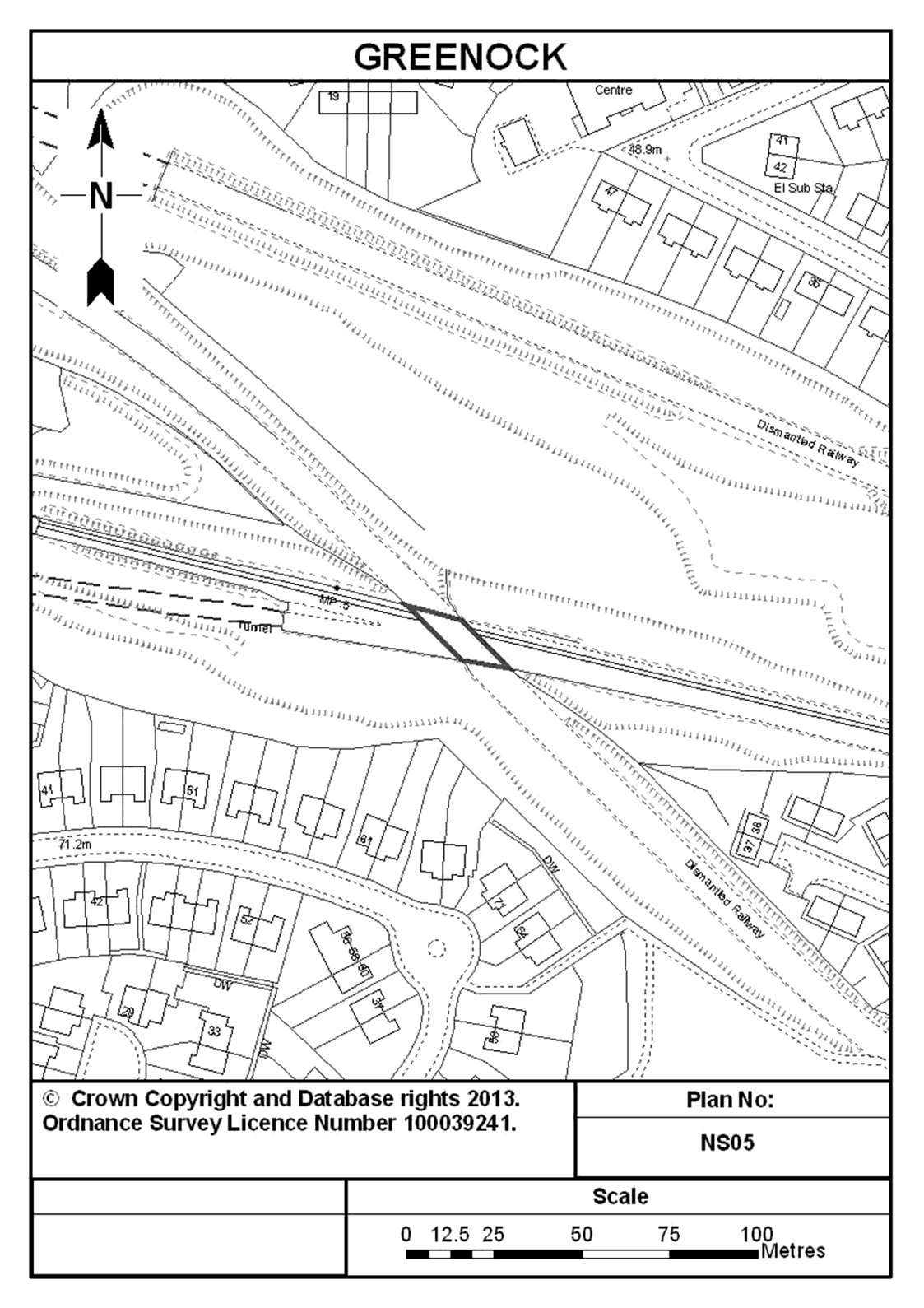
22. An underbridge north of Corlic Street at Greenock in Inverclyde that supported the Elderslie to Greenock Princes Pier closed railway line, and formerly spanned the operational railway between Whinhill Station and Bogston Junction, and shown marked in dark blue on plan NS05 entitled “Greenock” in the Annex to this Schedule.
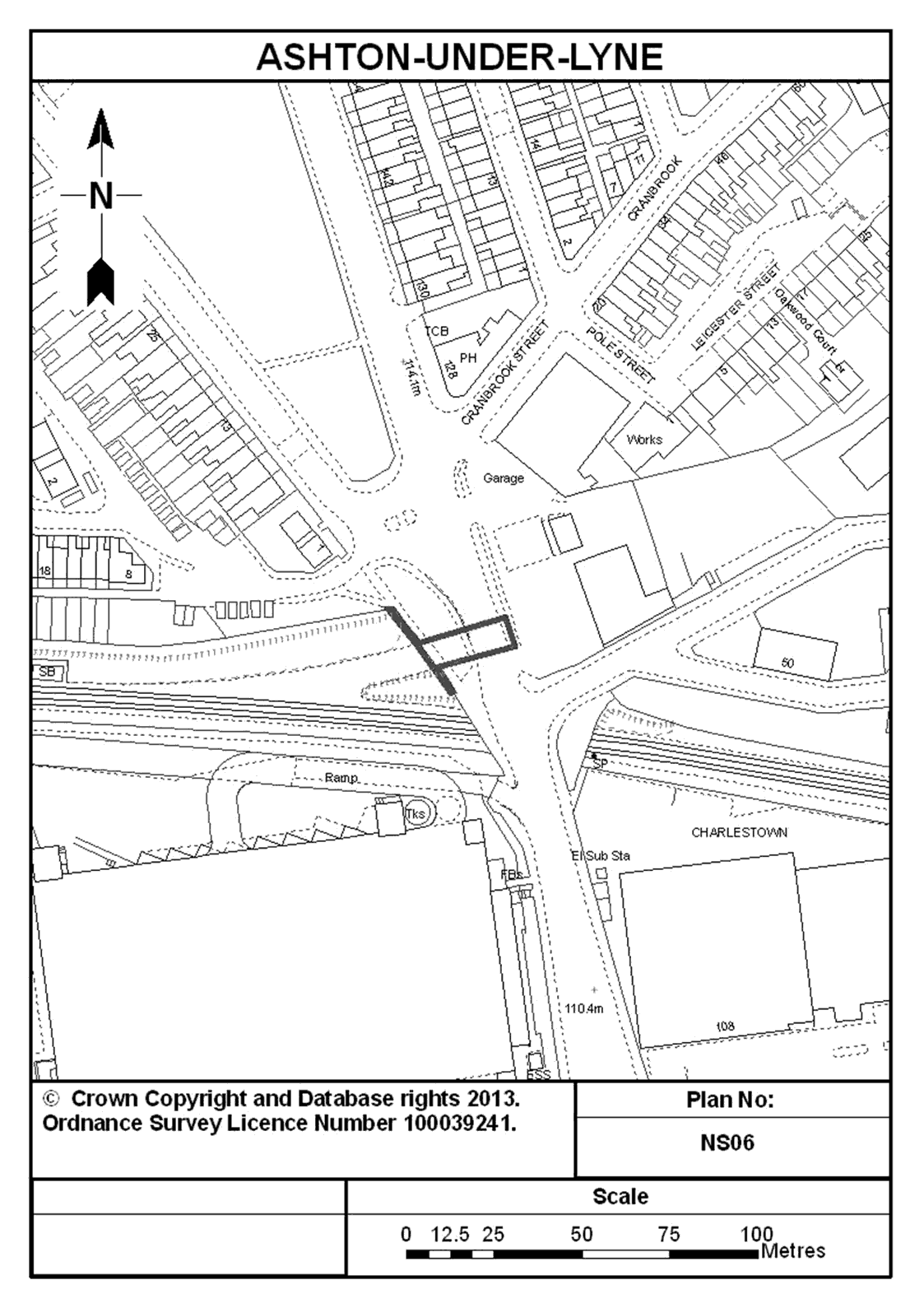
23. An overbridge at Ashton-under-Lyne in Greater Manchester that spans the Oldham to Ashton closed railway line, and now supports Oldham Road, Tameside, and shown marked in dark blue on plan NS06 entitled “Ashton-under-Lyne” in the Annex to this Schedule.
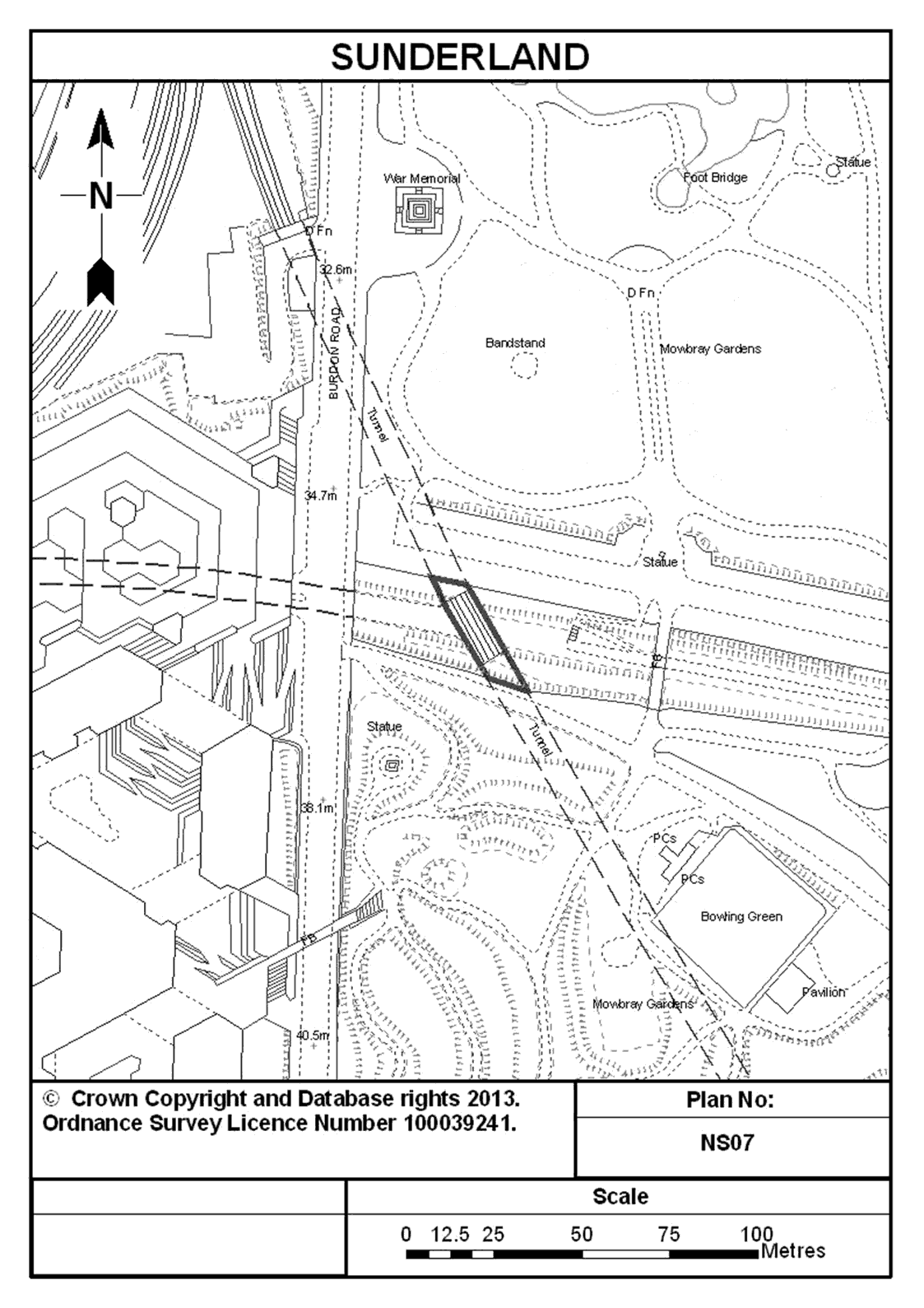
24. Abutments (retaining walls) east of Burdon Road in the City of Sunderland that were part of the former bridge that supported the Pallion Branch (Fawcett Street to Hendon Junction) closed railway line, and formerly spanned the operational railway between Sunderland and Seaham Stations, and shown marked in dark blue on plan NS07 entitled “Sunderland” in the Annex to this Schedule.
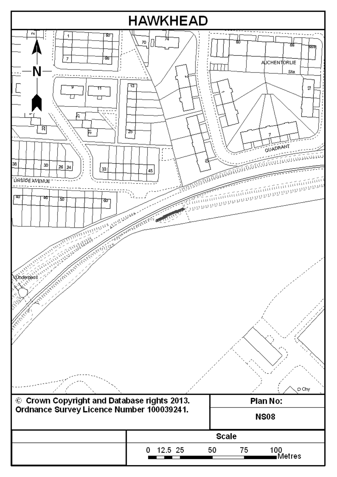
25. An abutment (retaining wall) south east of Linside Avenue at Hawkhead in Renfrewshire that was part of the former bridge that supported the Paisley (Lacy Street) to Blackbyres Junction closed railway line, and formerly spanned the operational railway between Paisley Canal and Hawkhead Stations, and shown marked in dark blue on plan NS08 entitled “Hawkhead” in the Annex to this Schedule.
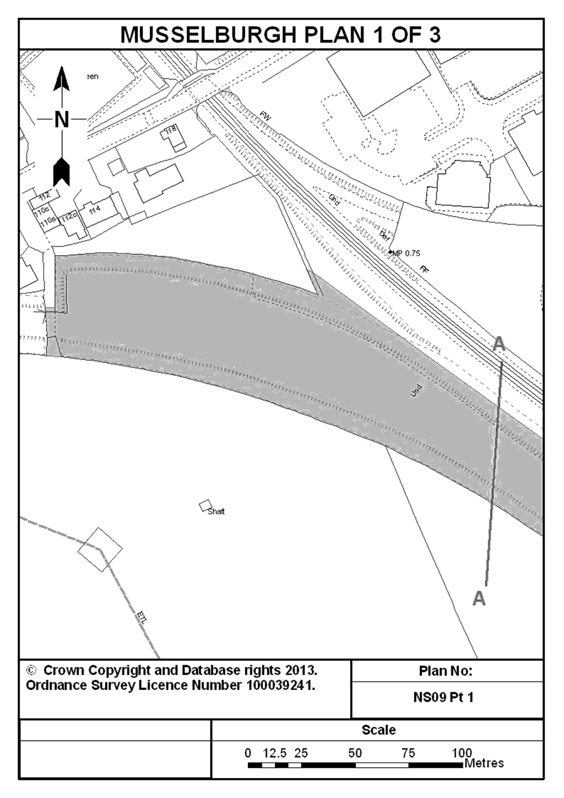
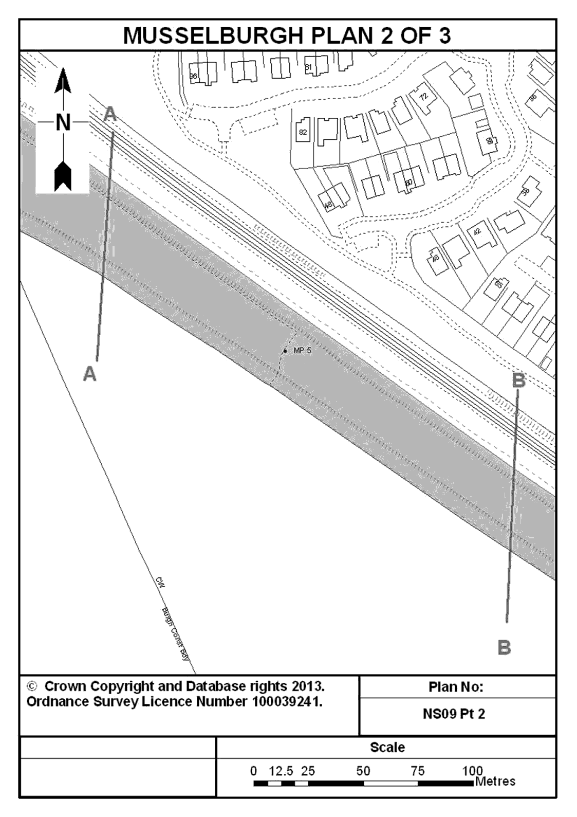
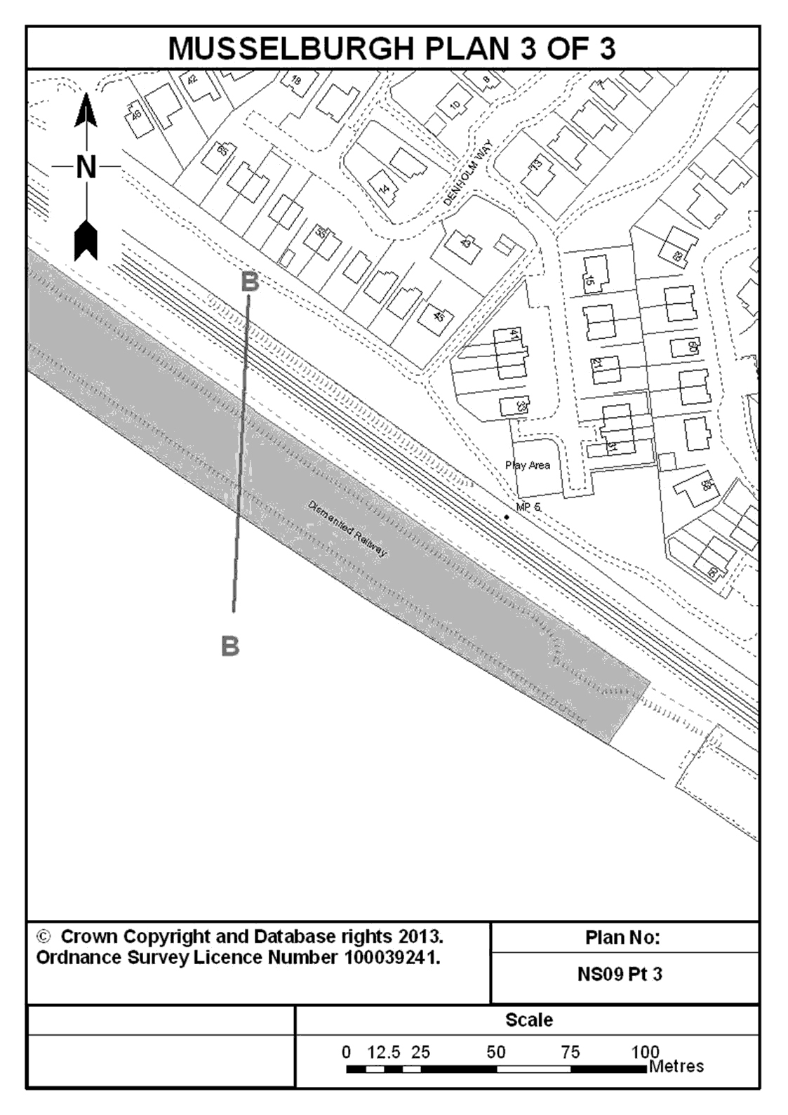
26. Land comprising an embankment and an adjoining bridge at Musselburgh comprising part of the Wanton Walls Junction to Niddrie North Junction (Lothian Lines) closed railway line, north west of Musselburgh railway station and adjacent to the operational railway between Musselburgh and Portobello Junction, partly in Edinburgh and partly in East Lothian and shown shaded in blue on plans NS09 Pt 1, NS09 Pt 2 and NS09 Pt 3 entitled “Musselburgh” in the Annex to this Schedule.
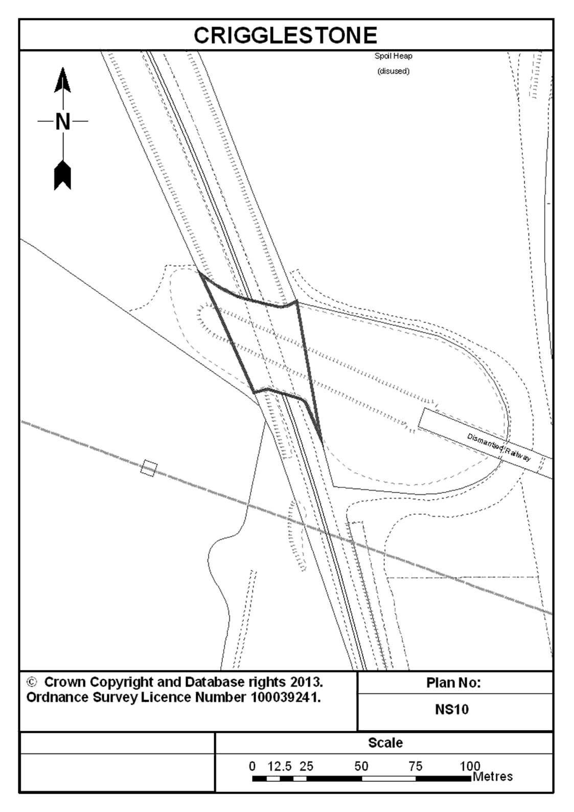
27. A tunnel and land at Crigglestone in West Yorkshire that supported the Royston to Dewsbury closed railway line west of Crigglestone Viaduct, and through which the operational railway between Horbury Junction and Crigglestone Junction passes, and shown marked in dark blue on plan NS10 entitled “Crigglestone” in the Annex to this Schedule.
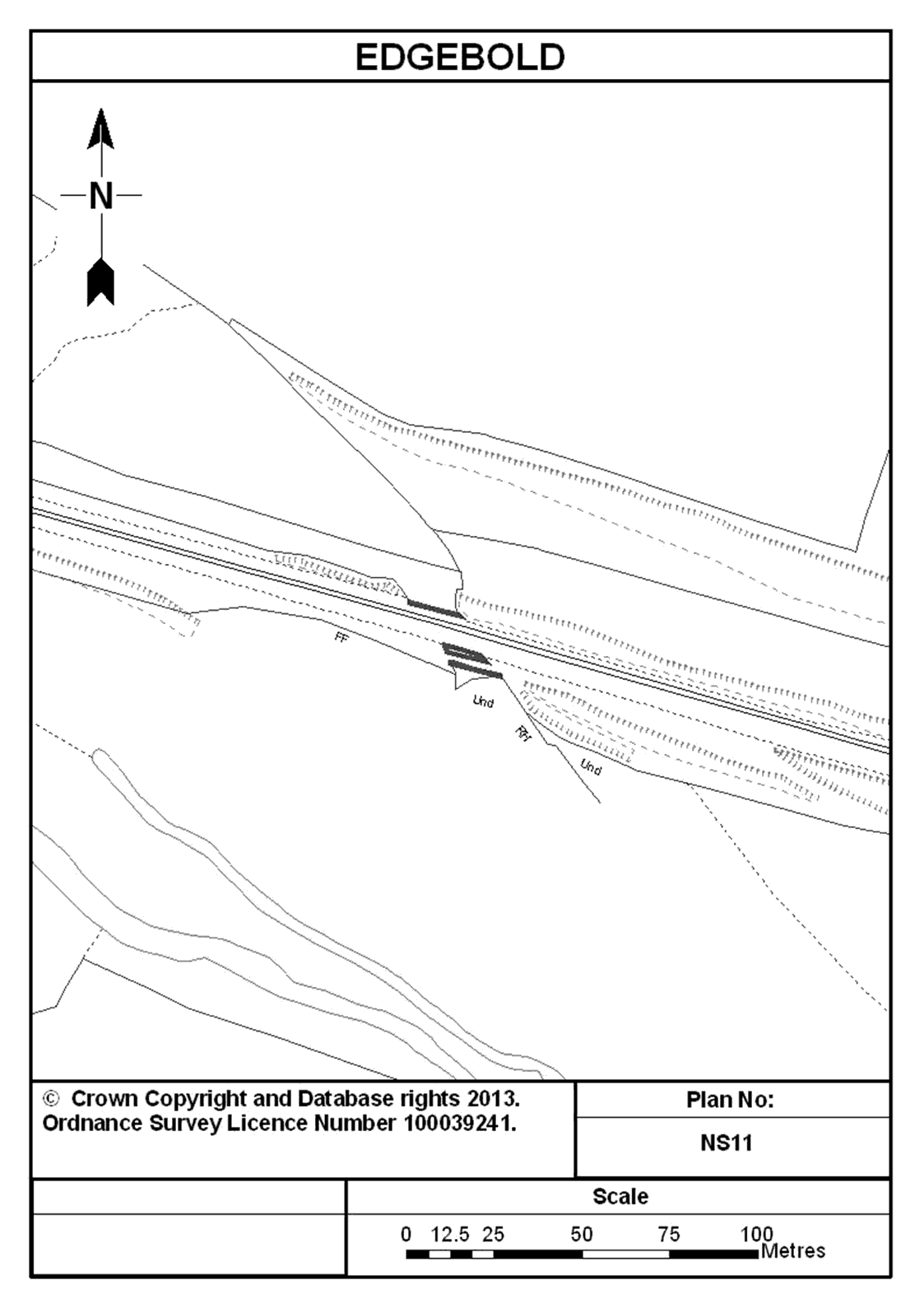
28. Abutments (retaining walls) and piers at Edgebold, east of Hanwood in Shropshire that were part of the former bridge that supported the Shropshire & Montgomeryshire closed railway line, and formerly spanned the operational railway between Welshpool and Shrewsbury Stations, and shown marked in dark blue on plan NS11 entitled “Edgebold” in the Annex to this Schedule.
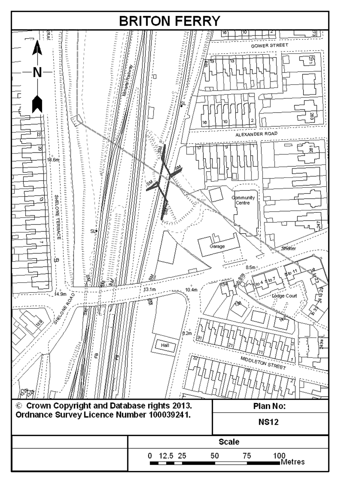
29. An underbridge south west of Alexander Road at Briton Ferry in the County Borough of Neath Port Talbot that supported the abandoned South Wales Mineral Railway, and spans the operational railway between Dynevor Junction and Briton Ferry, and shown marked in dark blue on plan NS12 entitled “Briton Ferry” in the Annex to this Schedule.
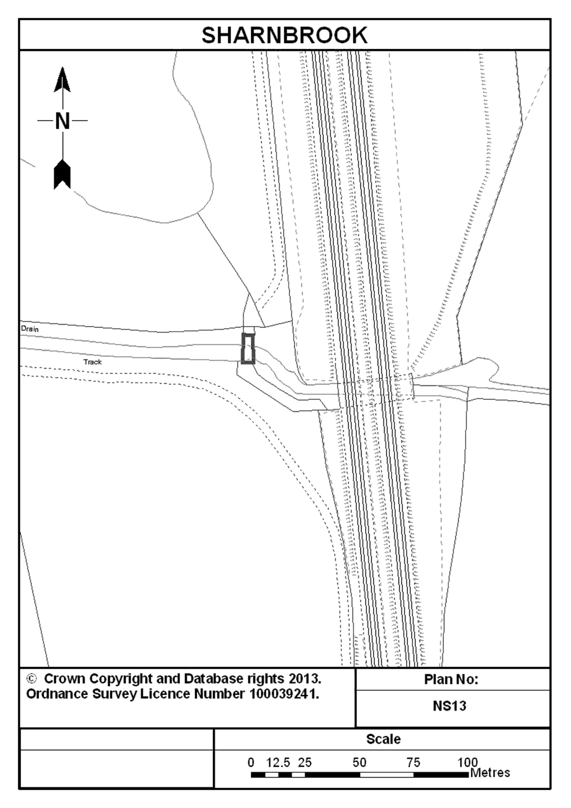
30. A sidebridge at Moor End, Sharnbrook in Bedfordshire that spans a stream and supports an access road to the operational railway and Sharnbrook Viaduct, adjacent to the operational railway between Sharnbrook Junction and Bedford, and shown marked in dark blue on plan NS13 entitled “Sharnbrook” in the Annex to this Schedule.
Registered Land
31. The property located at Moss Road and a parcel of land that was the site of the former sidings, Glazebrook near Warrington, and adjacent to the operational railway, registered under title numbers MAN150875 and MAN150858.
32. The property located at Cockshut Road Lewes and adjacent to the operational railway, registered under title number ESX318152.
33. The property located at Hurst Road and Temple Road in South Croydon and adjacent to the operational railway, registered under title number SGL598091.
34. The property located at Alexandra Palace and adjacent to the operational railway, registered under title number AGL156137.
35. The property located at Bicester Town railway station and adjacent to the operational railway, registered under title number ON269209.
36. The property located at Market Harborough comprising of the former goods yard off Rockingham Road, adjacent to the operational railway and registered under title number LT441613.
37. The property located at Hunslet Sidings and used as operational railway sidings, adjacent to the operational railway and registered under title number WYK894833.
38. Land adjoining the operational railway at Gobowen Railway Station in Shropshire and registered under title number SL191474.
39. The property located in Leicestershire and Nottinghamshire and known as the Old Dalby Test Track (including all associated structures and Unit F, Asfordby Business Park held under lease dated 16 February 2007 from EOS INC Limited), a high speed electrified railway for testing rolling stock, registered under the title numbers NT430786, NT482397, NT484734, NT430897, NT482398, NT482399, NT110834, NT484738, NT431009, NT482400, NT431058, NT482401, NT482569, NT431143, NT482570, NT482571, NT224834, LT399989, LT444693, LT396939, LT444694, LT446506, LT396975, LT444822, LT446539 and LT397207.
AnnexPLANS

Options/Help
Print Options
PrintThe Whole Instrument
PrintThis Schedule only

Legislation is available in different versions:
Latest Available (revised):The latest available updated version of the legislation incorporating changes made by subsequent legislation and applied by our editorial team. Changes we have not yet applied to the text, can be found in the ‘Changes to Legislation’ area.
Original (As Enacted or Made): The original version of the legislation as it stood when it was enacted or made. No changes have been applied to the text.
Opening Options
Different options to open legislation in order to view more content on screen at once
Explanatory Memorandum
Explanatory Memorandum sets out a brief statement of the purpose of a Statutory Instrument and provides information about its policy objective and policy implications. They aim to make the Statutory Instrument accessible to readers who are not legally qualified and accompany any Statutory Instrument or Draft Statutory Instrument laid before Parliament from June 2004 onwards.
More Resources
Access essential accompanying documents and information for this legislation item from this tab. Dependent on the legislation item being viewed this may include:
- the original print PDF of the as enacted version that was used for the print copy
- lists of changes made by and/or affecting this legislation item
- confers power and blanket amendment details
- all formats of all associated documents
- correction slips
- links to related legislation and further information resources
Impact Assessments
Impact Assessments generally accompany all UK Government interventions of a regulatory nature that affect the private sector, civil society organisations and public services. They apply regardless of whether the regulation originates from a domestic or international source and can accompany primary (Acts etc) and secondary legislation (SIs). An Impact Assessment allows those with an interest in the policy area to understand:
- Why the government is proposing to intervene;
- The main options the government is considering, and which one is preferred;
- How and to what extent new policies may impact on them; and,
- The estimated costs and benefits of proposed measures.
More Resources
Use this menu to access essential accompanying documents and information for this legislation item. Dependent on the legislation item being viewed this may include:
- the original print PDF of the as made version that was used for the print copy
- correction slips
Click 'View More' or select 'More Resources' tab for additional information including:
- lists of changes made by and/or affecting this legislation item
- confers power and blanket amendment details
- all formats of all associated documents
- links to related legislation and further information resources
 All content is available under the Open Government Licence v3.0 except where otherwise stated. This site additionally contains content derived from EUR-Lex, reused under the terms of the Commission Decision 2011/833/EU on the reuse of documents from the EU institutions. For more information see the EUR-Lex public statement on re-use.